Approximate Location Map
Large Map »
Latitude: 54.7706 / 54°46'14"N
Longitude: -1.5689 / 1°34'8"W
OS Eastings: 427829
OS Northings: 541827
OS Grid: NZ278418
Mapcode National: GBR KFH8.3N
Mapcode Global: WHC4Q.WC24
Plus Code: 9C6WQCCJ+6C
Entry Name: 37, Hallgarth Street
Listing Date: 10 March 1988
Grade: II
Source: Historic England
Source ID: 1120618
English Heritage Legacy ID: 110254
ID on this website: 101120618
Location: County Durham, DH1
County: County Durham
Electoral Ward/Division: Elvet and Gilesgate
Parish: City of Durham
Built-Up Area: Durham
Traditional County: Durham
Lieutenancy Area (Ceremonial County): County Durham
Church of England Parish: Durham St Oswald
Church of England Diocese: Durham
Tagged with: Building
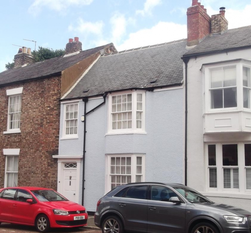
DURHAM AND FRAMWELLGATE HALLGARTH STREET
NZ 2741 NE (East side)
17/202 No. 37
GV II
House. Late C18. Painted render; Welsh slate roof with brick chimney.
2 storeys, 2 bays. 6-panel door and patterned overlight at left in Tuscan
doorcase; sash with glazing bars above; 2-storey canted bay at right. Steeply-
pitched roof has right end chimney.
Listing NGR: NZ2782941827
External links are from the relevant listing authority and, where applicable, Wikidata. Wikidata IDs may be related buildings as well as this specific building. If you want to add or update a link, you will need to do so by editing the Wikidata entry.


Other nearby listed buildings
