Approximate Location Map
Large Map »
Latitude: 54.5337 / 54°32'1"N
Longitude: -1.5796 / 1°34'46"W
OS Eastings: 427300
OS Northings: 515459
OS Grid: NZ273154
Mapcode National: GBR KJD0.TL
Mapcode Global: WHC5W.Q90R
Plus Code: 9C6WGCMC+F5
Entry Name: 19, Cockerton Green
Listing Date: 6 September 1977
Grade: II
Source: Historic England
Source ID: 1159805
English Heritage Legacy ID: 110566
ID on this website: 101159805
Location: Cockerton, Darlington, County Durham, DL3
County: Darlington
Electoral Ward/Division: Cockerton
Parish: Non Civil Parish
Built-Up Area: Darlington
Traditional County: Durham
Lieutenancy Area (Ceremonial County): County Durham
Church of England Parish: Cockerton
Church of England Diocese: Durham
Tagged with: Building
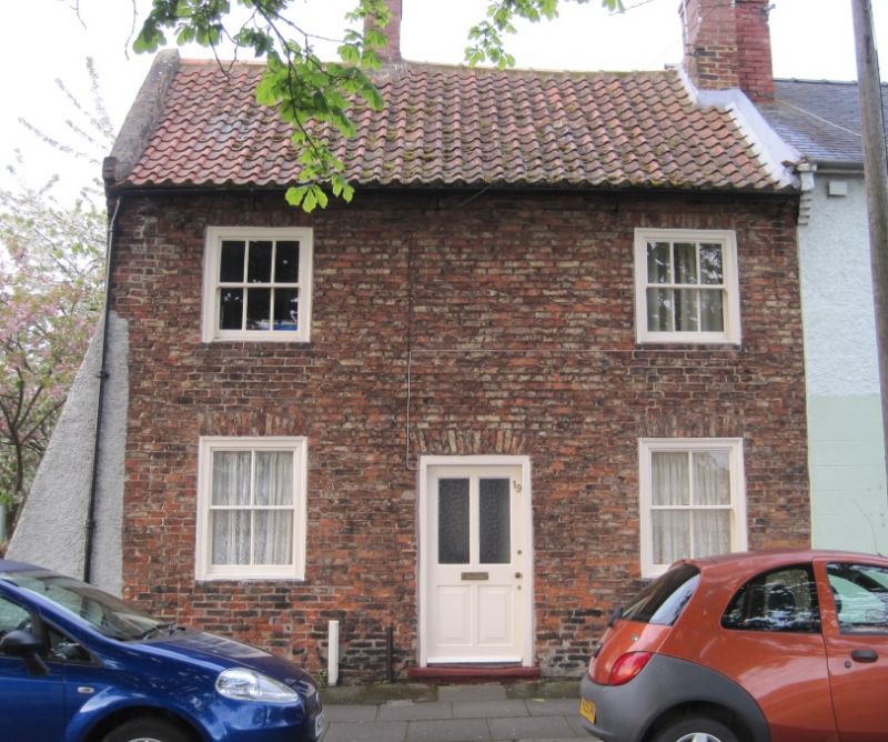
COCKERTON GREEN
1. (South Side)
5195
No 19
NZ 2715 1/276
II
2.
Late C18 2-storey, 2-window cotte of pinkish brick. Pantiled roof with centre
and right end chimneys. Replaced sash windows in flush wood architraves, those
on ground floor under flat gauged brick arches. Central 4-panel door.
Listing NGR: NZ2730015459
External links are from the relevant listing authority and, where applicable, Wikidata. Wikidata IDs may be related buildings as well as this specific building. If you want to add or update a link, you will need to do so by editing the Wikidata entry.


Other nearby listed buildings
