Approximate Location Map
Large Map »
Latitude: 54.5455 / 54°32'43"N
Longitude: -1.5588 / 1°33'31"W
OS Eastings: 428639
OS Northings: 516784
OS Grid: NZ286167
Mapcode National: GBR KHKW.BB
Mapcode Global: WHC5X.00ZN
Plus Code: 9C6WGCWR+6F
Entry Name: Wall to North of Number 279
Listing Date: 6 September 1977
Grade: II
Source: Historic England
Source ID: 1310408
English Heritage Legacy ID: 110662
ID on this website: 101310408
Location: Rise Carr, Darlington, County Durham, DL3
County: Darlington
Electoral Ward/Division: North Road
Parish: Non Civil Parish
Built-Up Area: Darlington
Traditional County: Durham
Lieutenancy Area (Ceremonial County): County Durham
Church of England Parish: Darlington St Mark with St Paul
Church of England Diocese: Durham
Tagged with: Wall
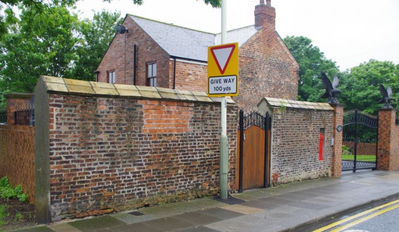
LONGFIELD ROAD
1.
5195
Wall to north
of No 279
NZ 21 NE 13/333
II
2.
High early C18 wall of narrow dark-red bricks. Blocked doorway framed in buttresses
and small blocked window. Tall coping of later date.
Listing NGR: NZ2863916784
External links are from the relevant listing authority and, where applicable, Wikidata. Wikidata IDs may be related buildings as well as this specific building. If you want to add or update a link, you will need to do so by editing the Wikidata entry.


Other nearby listed buildings
