Approximate Location Map
Large Map »
Latitude: 54.5249 / 54°31'29"N
Longitude: -1.5578 / 1°33'27"W
OS Eastings: 428721
OS Northings: 514494
OS Grid: NZ287144
Mapcode National: GBR KJK3.KQ
Mapcode Global: WHC5X.1JHG
Plus Code: 9C6WGCFR+XW
Entry Name: 21, Skinnergate
Listing Date: 6 September 1977
Grade: II
Source: Historic England
Source ID: 1121258
English Heritage Legacy ID: 110710
ID on this website: 101121258
Location: Darlington, County Durham, DL3
County: Darlington
Electoral Ward/Division: Park East
Parish: Non Civil Parish
Built-Up Area: Darlington
Traditional County: Durham
Lieutenancy Area (Ceremonial County): County Durham
Church of England Parish: Darlington Holy Trinity
Church of England Diocese: Durham
Tagged with: Building
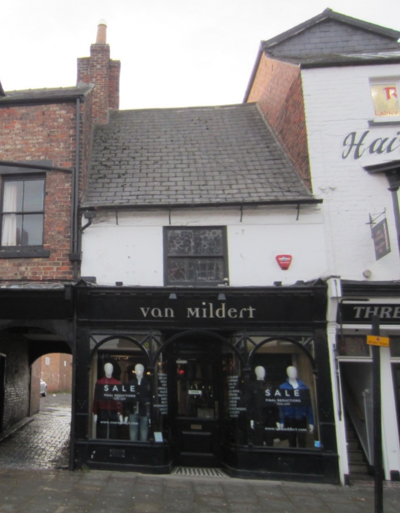
SKINNERGATE
1. (West Side)
5195
No 21
NZ 2814 SE 8/376
II
2.
Late C17 or early C18 house of 2 storeys, one window. Very high pitched swept
roof now covered in large Welsh slates. Stuccoed 1st floor with small replaced
sash window. Modern shop below.
Listing NGR: NZ2872114494
External links are from the relevant listing authority and, where applicable, Wikidata. Wikidata IDs may be related buildings as well as this specific building. If you want to add or update a link, you will need to do so by editing the Wikidata entry.


Other nearby listed buildings
