Approximate Location Map
Large Map »
Latitude: 54.58 / 54°34'47"N
Longitude: -1.5572 / 1°33'25"W
OS Eastings: 428721
OS Northings: 520621
OS Grid: NZ287206
Mapcode National: GBR KHKG.PZ
Mapcode Global: WHC5Q.14SR
Plus Code: 9C6WHCHV+X4
Entry Name: Glebe Farmhouse and Front Garden Wall
Listing Date: 6 June 1952
Last Amended: 16 July 1986
Grade: II
Source: Historic England
Source ID: 1121237
English Heritage Legacy ID: 110759
ID on this website: 101121237
Location: Coatham Mundeville, Darlington, County Durham, DL1
County: Darlington
Civil Parish: Coatham Mundeville
Traditional County: Durham
Lieutenancy Area (Ceremonial County): County Durham
Church of England Parish: Great Aycliffe
Church of England Diocese: Durham
Tagged with: Farmhouse
NZ 2820 COATHAM MUNDEVILLE THE COTTAGES
12/170 No.1
6/6/52 (Glebe Farmhouse)
and front garden
wall (previously
listed as Hall
Garth Farmhouse)
II
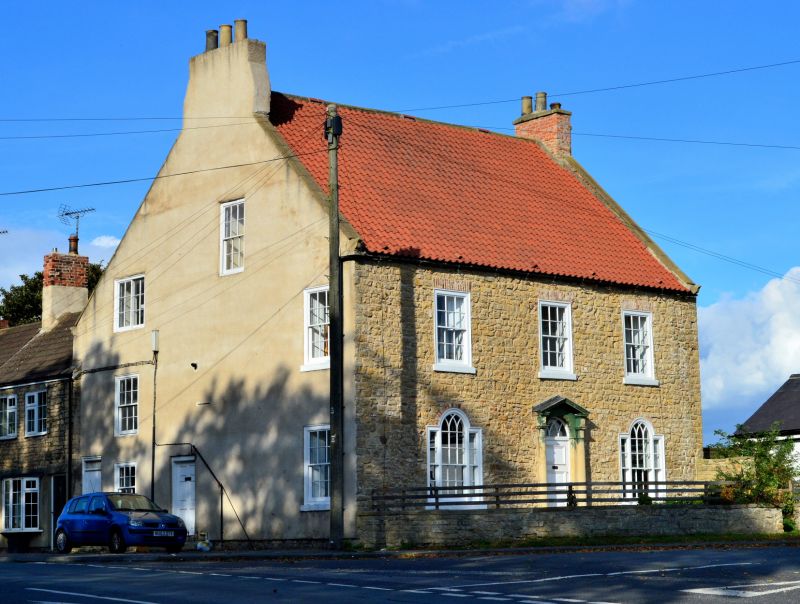
House and front garden wall. Mid C18. Squared limestone, pebble-dashed on
front and roughcast on left return. Renewed pantiled roof and rebuilt brick
chimney stacks. Squared limestone garden wall.
Tall 2-storey, 3-bay front. Central replaced door, and fanlight with
intersecting tracery, in open-pedimented wood doorcase with engaged columns
and fluted capitals. Flanking Venetian windows, with projecting sills, have
4+12+4-pane sashes and intersecting-tracery central heads. Three 12-pane sashes
above with projecting sills and flat-arched brick lintels. Steeply-pitched
roof with slightly-swept eaves. Renewed gable copings and shaped kneelers.
End stacks. Rear half of house projects slightly beyond front half at right.
Left return: off-centre 4-panel door with fielded panels; flanking 12-pane
sashes with projecting sills; smaller 12-pane sash in attic.
Low flat-coped, semicircular-plan front garden wall, adjoining ends of house,
has quadrant ramp at right.
Listing NGR: NZ2872120621
External links are from the relevant listing authority and, where applicable, Wikidata. Wikidata IDs may be related buildings as well as this specific building. If you want to add or update a link, you will need to do so by editing the Wikidata entry.


Other nearby listed buildings
