Approximate Location Map
Large Map »
Latitude: 54.5412 / 54°32'28"N
Longitude: -1.6952 / 1°41'42"W
OS Eastings: 419820
OS Northings: 516258
OS Grid: NZ198162
Mapcode National: GBR JHLX.SW
Mapcode Global: WHC5T.X3YZ
Plus Code: 9C6WG8R3+FW
Entry Name: White Cross Farmhouse
Listing Date: 6 June 1952
Last Amended: 16 July 1986
Grade: II
Source: Historic England
Source ID: 1139015
English Heritage Legacy ID: 110873
ID on this website: 101139015
Location: Darlington, County Durham, DL2
County: Darlington
Civil Parish: Piercebridge
Traditional County: Durham
Lieutenancy Area (Ceremonial County): County Durham
Church of England Parish: Coniscliffe
Church of England Diocese: Durham
Tagged with: Farmhouse
NZ 11 NE PIERCEBRIDGE A67(Gainford Road)
(North side, off)
4/145 White Cross Farmhouse
6/6/52 (Formerly listed as White
Cross Farmhouse with two
GV detached Lodges)
II
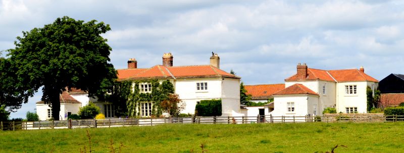
Farmhouse. Probably late C18 with early-mid C19 alterations and additions.
Squared rubble painted white. Pantiled roof with stone-flagged eaves. Brick
chimmey stacks. Wings added at right-angles to front and rear of original
farmhouse to produce cross plan.
2-storey, symmetrical garden front of 3 wide bays. Plinth, ground-floor sill
band, first-floor and eaves bands, flush quoins. Replaced door on short right
return of projecting centre bay. 3-light windows in projecting flat-faced
surrounds with chamfered stone mullions: windows with 4-pane sashes and lowered
sills on ground floor; shorter windows with 2-pane sashes above. Low-pitched
hipped roof also hipped over centre bay. Central ridge stack with stone top
band. Similar lateral stacks on rear walls of wings.
Rear: Far-projecting centre bay; single-storey outshut with pent roof on left;
short range of sheds with boarded doors and pent roof on right.
Listing NGR: NZ1982016258
External links are from the relevant listing authority and, where applicable, Wikidata. Wikidata IDs may be related buildings as well as this specific building. If you want to add or update a link, you will need to do so by editing the Wikidata entry.


Other nearby listed buildings
