Approximate Location Map
Large Map »
Latitude: 54.5174 / 54°31'2"N
Longitude: -2.0131 / 2°0'47"W
OS Eastings: 399248
OS Northings: 513570
OS Grid: NY992135
Mapcode National: GBR GJC6.YD
Mapcode Global: WHB4K.1QN7
Plus Code: 9C6VGX8P+XQ
Entry Name: Annums Farmhouse
Listing Date: 17 June 1986
Grade: II
Source: Historic England
Source ID: 1121073
English Heritage Legacy ID: 111183
ID on this website: 101121073
Location: Bowes, County Durham, DL12
County: County Durham
Civil Parish: Bowes
Traditional County: Yorkshire
Lieutenancy Area (Ceremonial County): County Durham
Tagged with: Farmhouse
BOWES THE STREET
NY 9913
(North side)
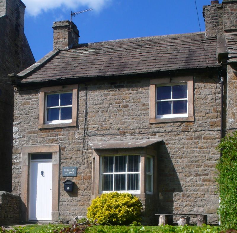
33/21 Annums Farmhouse
II
Farmhouse. Early C19. Squared rubble. Stone-flagged roof and stone chimmey
stacks.
2-storey, 2-bay front with 2-storey wing attached to rear. 4-panel door and
overlight in projecting surround at left. Small canted bay window to right has
fixed 2 + 6 + 2-pane lights and a sloping stone-slab roof. Two 4-pane sashes
above in projecting surrounds. Roof with coped gables and shaped kneelers.
End stacks with top ledges and water tables.
Listing NGR: NY9924813570
External links are from the relevant listing authority and, where applicable, Wikidata. Wikidata IDs may be related buildings as well as this specific building. If you want to add or update a link, you will need to do so by editing the Wikidata entry.


Other nearby listed buildings
