Approximate Location Map
Large Map »
Latitude: 54.5546 / 54°33'16"N
Longitude: -1.9781 / 1°58'41"W
OS Eastings: 401514
OS Northings: 517710
OS Grid: NZ015177
Mapcode National: GBR GHMS.K2
Mapcode Global: WHB4C.LS86
Plus Code: 9C6WH23C+VQ
Entry Name: The Beeches
Listing Date: 17 June 1986
Grade: II
Source: Historic England
Source ID: 1160595
English Heritage Legacy ID: 111272
ID on this website: 101160595
Location: Lartington, County Durham, DL12
County: County Durham
Civil Parish: Lartington
Traditional County: Yorkshire
Lieutenancy Area (Ceremonial County): County Durham
Tagged with: Architectural structure
LARTINGTON LARTINGTON GREEN LANE
NZ 0117
(North side)
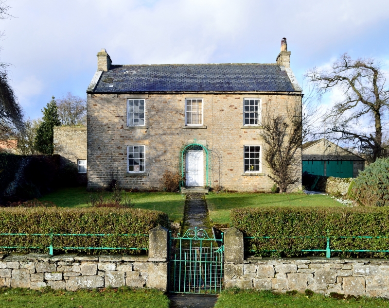
31/103 The Beeches
II
House. Circa 1840. Squared sandstone rubble; roof of large purple slates;
stone chimney stacks.
2 storeys, 3 bays, symmetrical. 2 steps to central replaced partly-glazed door
with patterned overlight under flush lintel. 12-pane sashes with flush lintels
and projecting sills. Roof with coped gables. End stacks with top bands.
Listing NGR: NZ0151417710
External links are from the relevant listing authority and, where applicable, Wikidata. Wikidata IDs may be related buildings as well as this specific building. If you want to add or update a link, you will need to do so by editing the Wikidata entry.


Other nearby listed buildings
