Approximate Location Map
Large Map »
Latitude: 54.5323 / 54°31'56"N
Longitude: -1.905 / 1°54'18"W
OS Eastings: 406243
OS Northings: 515225
OS Grid: NZ062152
Mapcode National: GBR HJ41.C2
Mapcode Global: WHB4L.QB1V
Plus Code: 9C6WG3JV+WX
Entry Name: Road Bridge over Thorsgill
Listing Date: 12 January 1967
Last Amended: 28 October 1987
Grade: II
Source: Historic England
Source ID: 1322743
English Heritage Legacy ID: 111686
ID on this website: 101322743
Location: Egglestone Abbey, County Durham, DL12
County: County Durham
Civil Parish: Egglestone Abbey
Traditional County: Yorkshire
Lieutenancy Area (Ceremonial County): County Durham
Tagged with: Road bridge
NZ 01 NE EGGLESTONE ABBEY ABBEY LANE
2/97 Road Bridge over
Thorsgill
12.1.67 (formerly listed
as Road Bridge
YNR 742)
GV II
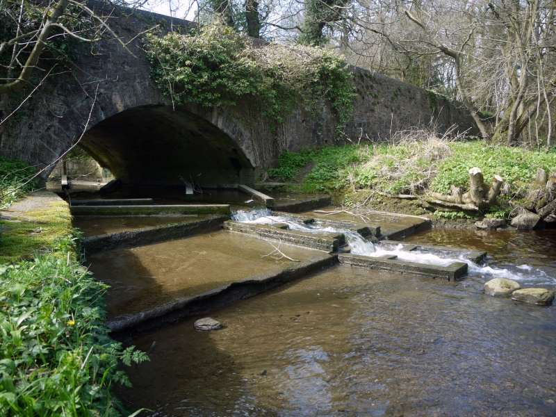
Road bridge, late C18 or C19. Coursed large rubble with roughly-tooled
voussoirs. One segmental arch; parapet walls with later concrete coping.
Included for group value with Bow Bridge (q.v.).
Partly in Startforth parish.
Listing NGR: NZ0623815224
External links are from the relevant listing authority and, where applicable, Wikidata. Wikidata IDs may be related buildings as well as this specific building. If you want to add or update a link, you will need to do so by editing the Wikidata entry.


Other nearby listed buildings
