Approximate Location Map
Large Map »
Latitude: 54.6848 / 54°41'5"N
Longitude: -1.8497 / 1°50'58"W
OS Eastings: 409788
OS Northings: 532204
OS Grid: NZ097322
Mapcode National: GBR HGJ8.BD
Mapcode Global: WHC4Z.KHDX
Plus Code: 9C6WM5M2+W4
Entry Name: Gate Piers 100 Metres East of Hoppyland Hall
Listing Date: 26 November 1987
Grade: II
Source: Historic England
Source ID: 1322799
English Heritage Legacy ID: 111978
ID on this website: 101322799
Location: Bedburn, County Durham, DL13
County: County Durham
Civil Parish: South Bedburn
Traditional County: Durham
Lieutenancy Area (Ceremonial County): County Durham
Church of England Parish: Hamsterley
Church of England Diocese: Durham
Tagged with: Gatepost
SOUTH BEDBURN SOUTH BEDBURN
NZ 03 SE
10/176 Gate piers 100
metres east of
Hoppyland Hall
GV II
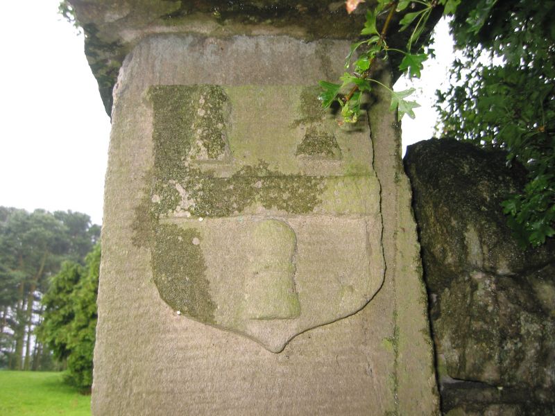
Gate piers. Dated 1842. Sandstone ashlar. 2 tapered square piers with
overlapping domed pyramid coping; low-relief cross, with date 1842 and
heraldic shield, on each pier.
Listing NGR: NZ0978832204
External links are from the relevant listing authority and, where applicable, Wikidata. Wikidata IDs may be related buildings as well as this specific building. If you want to add or update a link, you will need to do so by editing the Wikidata entry.


Other nearby listed buildings
