Approximate Location Map
Large Map »
Latitude: 51.9451 / 51°56'42"N
Longitude: 0.6397 / 0°38'22"E
OS Eastings: 581523
OS Northings: 230691
OS Grid: TL815306
Mapcode National: GBR QJL.0JJ
Mapcode Global: VHJJ6.1CJQ
Plus Code: 9F32WJWQ+2V
Entry Name: Parish Church of St Andrew
Listing Date: 24 February 1950
Grade: I
Source: Historic England
Source ID: 1338284
English Heritage Legacy ID: 113855
ID on this website: 101338284
Location: St Andrews Church, Halstead, Braintree, Essex, CO9
County: Essex
District: Braintree
Civil Parish: Halstead
Built-Up Area: Halstead
Traditional County: Essex
Lieutenancy Area (Ceremonial County): Essex
Church of England Parish: Halstead St Andrew with Holy Trinity
Church of England Diocese: Chelmsford
Tagged with: Church building
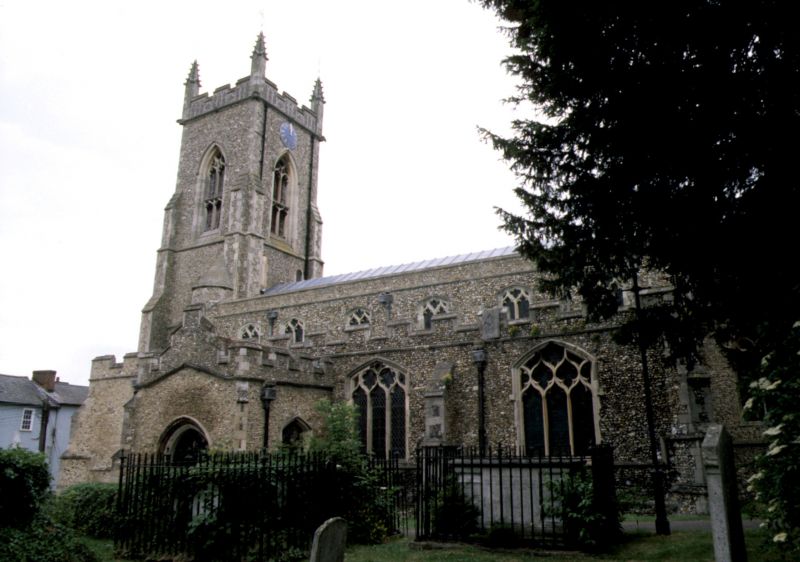
1.
5210 HEAD STREET
Parish Church of
St Andrew
TL 8130 NE 2/51 24.2.50.
I GV
2.
Principally C14 and C15, much restored in C19 with west tower of circa 1850.
Monuments, include tomb chests with effigies of the Bourchier family. One dated
1400 has richly carved canopy. Early C15 brasses. (R.C.H.M.1).
Listing NGR: TL8152330691
External links are from the relevant listing authority and, where applicable, Wikidata. Wikidata IDs may be related buildings as well as this specific building. If you want to add or update a link, you will need to do so by editing the Wikidata entry.


Other nearby listed buildings
