Approximate Location Map
Large Map »
Latitude: 51.9659 / 51°57'57"N
Longitude: 0.6845 / 0°41'4"E
OS Eastings: 584520
OS Northings: 233114
OS Grid: TL845331
Mapcode National: GBR QJ7.RW2
Mapcode Global: VHJJ0.TV7B
Plus Code: 9F32XM8M+8R
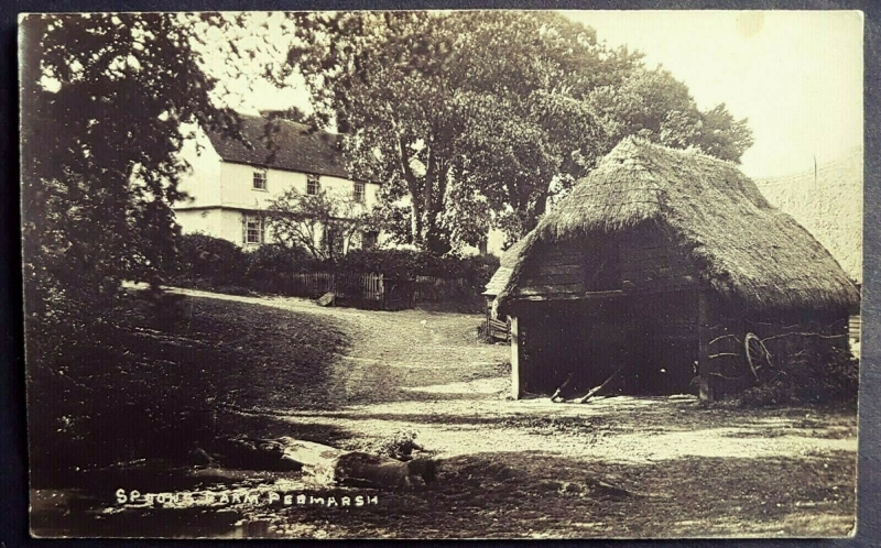
Entry Name: Spoons Hall
Listing Date: 7 August 1952
Grade: II
Source: Historic England
Source ID: 1338102
English Heritage Legacy ID: 114884
ID on this website: 101338102
Location: Clay Hills, Braintree, Essex, CO9
County: Essex
District: Braintree
Civil Parish: Pebmarsh
Traditional County: Essex
Lieutenancy Area (Ceremonial County): Essex
Church of England Parish: Pebmarsh St John the Baptist
Church of England Diocese: Chelmsford
Tagged with: House
PEBMARSH
TL 83 SW
3/86 (28/594) Spoons Hall
7.8.52
GV II
House. Early C16, extended in later C16, C17 and C20. Timber framed, plastered
with some exposed framing, roofed with handmade red clay tiles. Complex plan,
consisting of 2-bay hall range aligned N-S with axial stack in N bay, C17
extension to E, C17 2-storey lean-to extension to N, and C20 single-storey
extension beyond. C16 crosswing to S, C16 range beyond, stair tower of c.1600
to W, and C18 extension in SW angle. The original front was to the W, and the
crosswing is jettied on this side, with exposed joists and 3 plain brackets, but
the E (garden) elevation is now more important. 2 storeys. Exposed framing,
continuous jetty on E elevation (with 4 plain brackets) and S elevation with
dragon beam and corner bracket. Close studding, 'Suffolk' bracing. 2 C20
splayed bays and C20 casements above. 4 late C16 windows with 2, 3, 2 and 2
mullions, restored. Blocked door with 4-centred doorhead, restored. Original
sprockets. Grouped diagonal shafts. The interior has jowled posts, exposed
heavy studding, chamfered beams, crownpost roofs over hall range and crosswing,
queenpost roof with curved wind bracing to side purlins in S range. Restored in
early C20, with some original features re-sited. RCHM 12.
Listing NGR: TL8452033114
External links are from the relevant listing authority and, where applicable, Wikidata. Wikidata IDs may be related buildings as well as this specific building. If you want to add or update a link, you will need to do so by editing the Wikidata entry.


Other nearby listed buildings
