Approximate Location Map
Large Map »
Latitude: 51.9094 / 51°54'33"N
Longitude: 0.9257 / 0°55'32"E
OS Eastings: 601340
OS Northings: 227471
OS Grid: TM013274
Mapcode National: GBR SN0.6VN
Mapcode Global: VHKG0.088M
Plus Code: 9F32WW5G+P7
Entry Name: Rovers Tye Farmhouse
Listing Date: 2 December 1971
Grade: II
Source: Historic England
Source ID: 1337721
English Heritage Legacy ID: 117048
ID on this website: 101337721
Location: Colchester, Essex, CO4
County: Essex
District: Colchester
Electoral Ward/Division: Highwoods
Parish: Non Civil Parish
Built-Up Area: Colchester
Traditional County: Essex
Lieutenancy Area (Ceremonial County): Essex
Church of England Parish: Saint Luke Colchester
Church of England Diocese: Chelmsford
Tagged with: Farmhouse
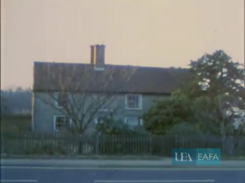
1. IPSWICH ROAD
995 -------------
Rovers Tye Farmhouse
TM 02 NW 17/463
II
2.
Late C17/early C18. Timber framed and rendered. 2 storeys, 5 windows,
sashes with glazing bars. Panelled door. Tiled roof, central brick
chimney.
Listing NGR: TM0134027471
External links are from the relevant listing authority and, where applicable, Wikidata. Wikidata IDs may be related buildings as well as this specific building. If you want to add or update a link, you will need to do so by editing the Wikidata entry.


Other nearby listed buildings
