Approximate Location Map
Large Map »
Latitude: 51.5092 / 51°30'33"N
Longitude: 0.3583 / 0°21'29"E
OS Eastings: 563751
OS Northings: 181558
OS Grid: TQ637815
Mapcode National: GBR NLS.7DT
Mapcode Global: VHJL5.5B8C
Plus Code: 9F32G955+M8
Entry Name: Slades Hold Cottages
Listing Date: 8 November 1976
Grade: II
Source: Historic England
Source ID: 1111608
English Heritage Legacy ID: 119708
ID on this website: 101111608
Location: Baker Street, Thurrock, Essex, RM16
County: Thurrock
Electoral Ward/Division: Orsett
Parish: Non Civil Parish
Built-Up Area: Baker Street
Traditional County: Essex
Lieutenancy Area (Ceremonial County): Essex
Church of England Parish: Orsett; St Giles and All Saints
Church of England Diocese: Chelmsford
Tagged with: Cottage Thatched cottage
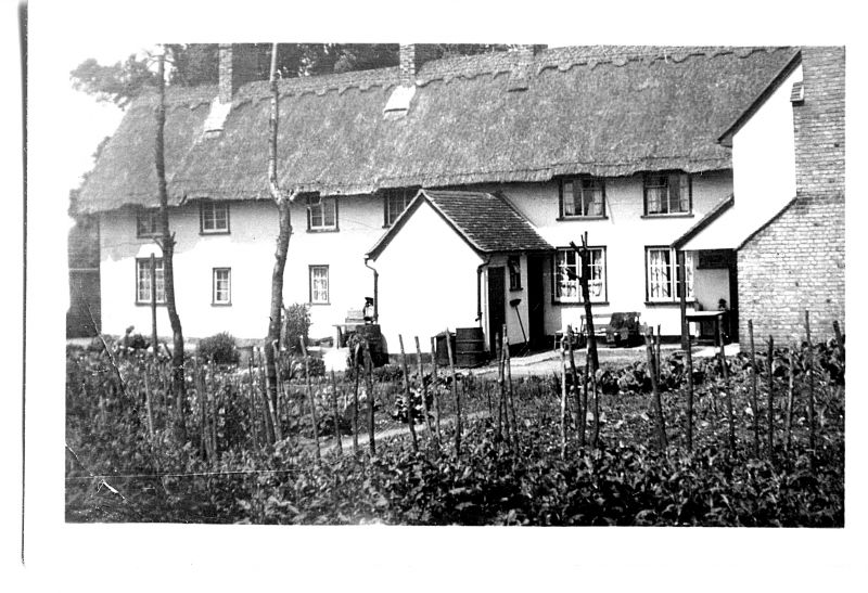
1. HIGH ROAD
5221 Orsett
(south side)
Nos 93 to 99 (odd)
Slades Hold Cottage
TQ 68 SW 5/33 8.11.76
II
2.
Late C17 terrace of cottages. Timber-framed and plastered, with thatched
roof. Two storeys. Six windows range modern casements.
Listing NGR: TQ6375181558
External links are from the relevant listing authority and, where applicable, Wikidata. Wikidata IDs may be related buildings as well as this specific building. If you want to add or update a link, you will need to do so by editing the Wikidata entry.


Other nearby listed buildings
