Approximate Location Map
Large Map »
Latitude: 51.5055 / 51°30'19"N
Longitude: 0.2255 / 0°13'31"E
OS Eastings: 554552
OS Northings: 180853
OS Grid: TQ545808
Mapcode National: GBR VC.TSZ
Mapcode Global: VHHNM.VFL7
Plus Code: 9F32G64G+56
Entry Name: Lennard Arms Inn
Listing Date: 10 November 1981
Grade: II
Source: Historic England
Source ID: 1337102
English Heritage Legacy ID: 119742
ID on this website: 101337102
Location: Wennington, Havering, London, RM13
County: London
District: Havering
Electoral Ward/Division: Rainham and Wennington
Parish: Non Civil Parish
Traditional County: Essex
Lieutenancy Area (Ceremonial County): Greater London
Church of England Parish: Mardyke
Church of England Diocese: Chelmsford
Tagged with: Pub
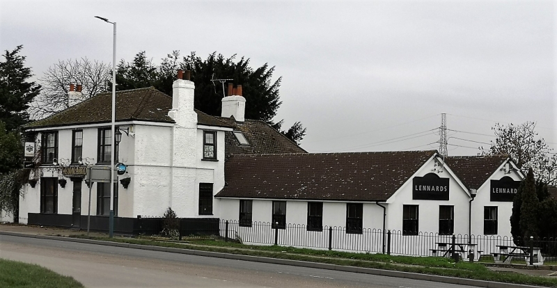
1.
5221 LONDON ROAD
Aveley
Lennard Arms Inn
TQ 58 SW 3A/1
II
2.
Early C19 house in rendered brick, facing C16 timber-framed wing at rear.
Two storeys. Modern roofs and windows. Some original detailing remains
internally.
Listing NGR: TQ5455280853
External links are from the relevant listing authority and, where applicable, Wikidata. Wikidata IDs may be related buildings as well as this specific building. If you want to add or update a link, you will need to do so by editing the Wikidata entry.


Other nearby listed buildings
