Approximate Location Map
Large Map »
Latitude: 51.7945 / 51°47'40"N
Longitude: 0.2669 / 0°16'0"E
OS Eastings: 556428
OS Northings: 213082
OS Grid: TL564130
Mapcode National: GBR MFV.G93
Mapcode Global: VHHM9.K5Z5
Plus Code: 9F32Q7V8+RQ
Entry Name: Windmill
Listing Date: 7 February 1952
Grade: II
Source: Historic England
Source ID: 1111983
English Heritage Legacy ID: 120603
ID on this website: 101111983
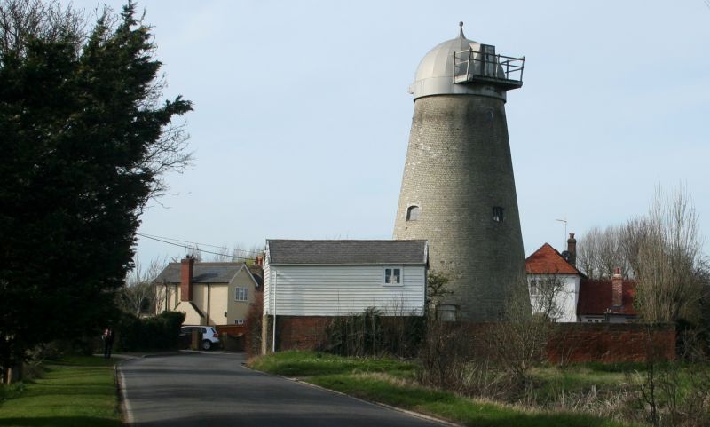
TL51SE WHITE RODING CHURCH ROAD
8/146 Windmill
7.2.52
GV II
Late C19 Tower Windmill of yellow brick with round weatherboard cap and small
ball finial. This mill replaced the post mill blown down 1877 and was working
until 1931. Said to be the last Windmill built in Essex.
Listing NGR: TL5642813082
External links are from the relevant listing authority and, where applicable, Wikidata. Wikidata IDs may be related buildings as well as this specific building. If you want to add or update a link, you will need to do so by editing the Wikidata entry.


Other nearby listed buildings
