Approximate Location Map
Large Map »
Latitude: 52.0499 / 52°2'59"N
Longitude: -1.7825 / 1°46'56"W
OS Eastings: 415013
OS Northings: 239076
OS Grid: SP150390
Mapcode National: GBR 4NG.D5T
Mapcode Global: VHB13.2Q1Y
Plus Code: 9C4W26X9+X2
Entry Name: Cutts Garage
Listing Date: 25 August 1960
Grade: II
Source: Historic England
Source ID: 1078404
English Heritage Legacy ID: 126189
ID on this website: 101078404
Location: Chipping Campden, Cotswold, Gloucestershire, GL55
County: Gloucestershire
District: Cotswold
Civil Parish: Chipping Campden
Built-Up Area: Chipping Campden
Traditional County: Gloucestershire
Lieutenancy Area (Ceremonial County): Gloucestershire
Church of England Parish: Chipping Campden St James
Church of England Diocese: Gloucester
Tagged with: Building
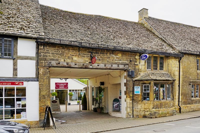
1.
5224 HIGH STREET
(south-east side)
Cutts Garage
SP 1539 SW 9/133 25.8.60
II GV
2.
The old forge. C17. Two storeys. Squared rubble. Cotswold stone roof. On ground
floor a 1:3:1 stone bay window with a 3 light stone mullion window above. C20 2 storey
garage entrance to left.
Listing NGR: SP1501639070
External links are from the relevant listing authority and, where applicable, Wikidata. Wikidata IDs may be related buildings as well as this specific building. If you want to add or update a link, you will need to do so by editing the Wikidata entry.


Other nearby listed buildings
