Approximate Location Map
Large Map »
Latitude: 51.8853 / 51°53'7"N
Longitude: -1.7588 / 1°45'31"W
OS Eastings: 416694
OS Northings: 220774
OS Grid: SP166207
Mapcode National: GBR 4QF.L5D
Mapcode Global: VHB1W.GWJ3
Plus Code: 9C3WV6PR+4F
Entry Name: Gates and Gatepiers to Manor House
Listing Date: 12 August 1983
Grade: II
Source: Historic England
Source ID: 1341631
English Heritage Legacy ID: 126438
ID on this website: 101341631
Location: Bourton-on-the-Water, Cotswold, Gloucestershire, GL54
County: Gloucestershire
District: Cotswold
Civil Parish: Bourton-on-the-Water
Built-Up Area: Bourton-on-the-Water
Traditional County: Gloucestershire
Lieutenancy Area (Ceremonial County): Gloucestershire
Church of England Parish: Bourton-on-the-Water with Clapton St Lawrence
Church of England Diocese: Gloucester
Tagged with: Gate
1.
5224 HIGH STREET
(south-west side)
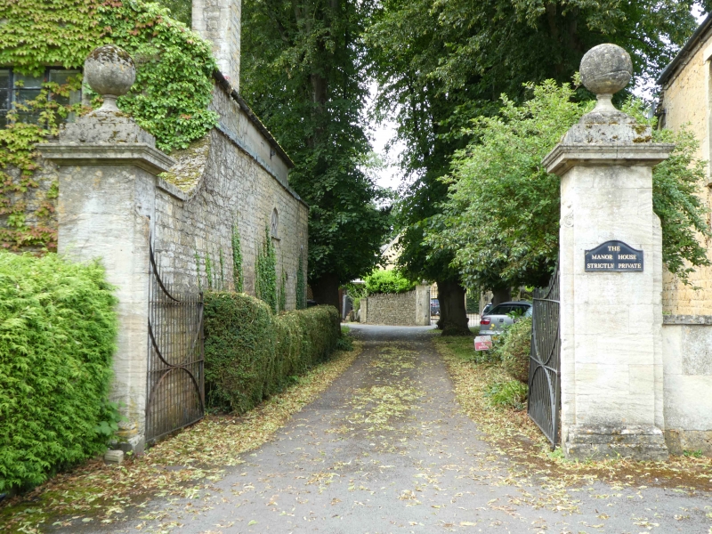
Gates and gate piers to
Manor House
SP 1620 NE 3/58
II
GV
2.
Probably late C19 but in C18 style. Square ashlar piers with moulded cornices and
ball finials. Wrought iron gates.
Listing NGR: SP1669420774
External links are from the relevant listing authority and, where applicable, Wikidata. Wikidata IDs may be related buildings as well as this specific building. If you want to add or update a link, you will need to do so by editing the Wikidata entry.


Other nearby listed buildings
