Approximate Location Map
Large Map »
Latitude: 52.0587 / 52°3'31"N
Longitude: -1.7289 / 1°43'44"W
OS Eastings: 418680
OS Northings: 240065
OS Grid: SP186400
Mapcode National: GBR 4NB.V0P
Mapcode Global: VHB13.ZJB5
Plus Code: 9C4W375C+FC
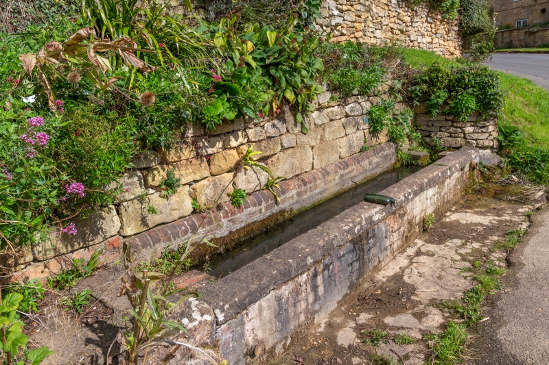
Entry Name: The Long Well Opposite Home Farm
Listing Date: 20 February 1985
Grade: II
Source: Historic England
Source ID: 1088520
English Heritage Legacy ID: 126983
ID on this website: 101088520
Location: Ebrington, Cotswold, Gloucestershire, GL55
County: Gloucestershire
District: Cotswold
Civil Parish: Ebrington
Built-Up Area: Ebrington
Traditional County: Gloucestershire
Lieutenancy Area (Ceremonial County): Gloucestershire
Church of England Parish: Ebrington St Eadburgha
Church of England Diocese: Gloucester
Tagged with: Building
SP 1840-1940 EBRINGTON MAIN STREET
(north Side)
13/44 The Long Well opposite Home Farm
II
Water trough of unusual length. C19. Brick with limestone
capping stones. Outlet on right, formerly on left also. About 5m
long.
Listing NGR: SP1868040065
External links are from the relevant listing authority and, where applicable, Wikidata. Wikidata IDs may be related buildings as well as this specific building. If you want to add or update a link, you will need to do so by editing the Wikidata entry.


Other nearby listed buildings
