Approximate Location Map
Large Map »
Latitude: 51.6633 / 51°39'47"N
Longitude: -1.7492 / 1°44'56"W
OS Eastings: 417445
OS Northings: 196089
OS Grid: SU174960
Mapcode National: GBR 4T4.NL1
Mapcode Global: VHB31.MGN7
Plus Code: 9C3WM772+88
Entry Name: Hannington Bridge
Listing Date: 23 April 1982
Grade: II
Source: Historic England
Source ID: 1341303
English Heritage Legacy ID: 128928
ID on this website: 101341303
Location: Cotswold, Gloucestershire, SN6
County: Gloucestershire
District: Cotswold
Civil Parish: Kempsford
Traditional County: Gloucestershire
Lieutenancy Area (Ceremonial County): Wiltshire
Church of England Parish: Kempsford with Whelford
Church of England Diocese: Gloucester
Tagged with: Road bridge
SU 19 NE KEMPSFORD -
8/84 Hannington Bridge
23.4.82
II
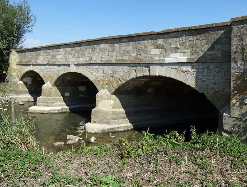
Road bridge over River Thames. 1841. Coursed rubble stone with
plat band above arches, rubble stone on road side. Three segmental
keyed arches between ashlar end piers and with pointed breakwaters.
High parapet with slightly weathered coping. Roadway about 5m
wide, 17m long. (V.C.H., Vol VII.)
Listing NGR: SU1744596089
External links are from the relevant listing authority and, where applicable, Wikidata. Wikidata IDs may be related buildings as well as this specific building. If you want to add or update a link, you will need to do so by editing the Wikidata entry.


Other nearby listed buildings
