Approximate Location Map
Large Map »
Latitude: 51.7087 / 51°42'31"N
Longitude: -1.7821 / 1°46'55"W
OS Eastings: 415153
OS Northings: 201134
OS Grid: SP151011
Mapcode National: GBR 4SJ.SBL
Mapcode Global: VHB2V.297X
Plus Code: 9C3WP659+F5
Entry Name: Nine Monuments, Including Carter and Telling, About 17 Metres South of South East Porch Buttress, in Churchyard of Church of St Mary
Listing Date: 17 June 1986
Grade: II
Source: Historic England
Source ID: 1090002
English Heritage Legacy ID: 129705
ID on this website: 101090002
Location: St Mary's Church, Fairford, Cotswold, Gloucestershire, GL7
County: Gloucestershire
District: Cotswold
Civil Parish: Fairford
Built-Up Area: Fairford
Traditional County: Gloucestershire
Lieutenancy Area (Ceremonial County): Gloucestershire
Church of England Parish: South Cotswold Team Ministry
Church of England Diocese: Gloucester
Tagged with: Monument
SP 1401-1501 FAIRFORD HIGH STREET
(west side)
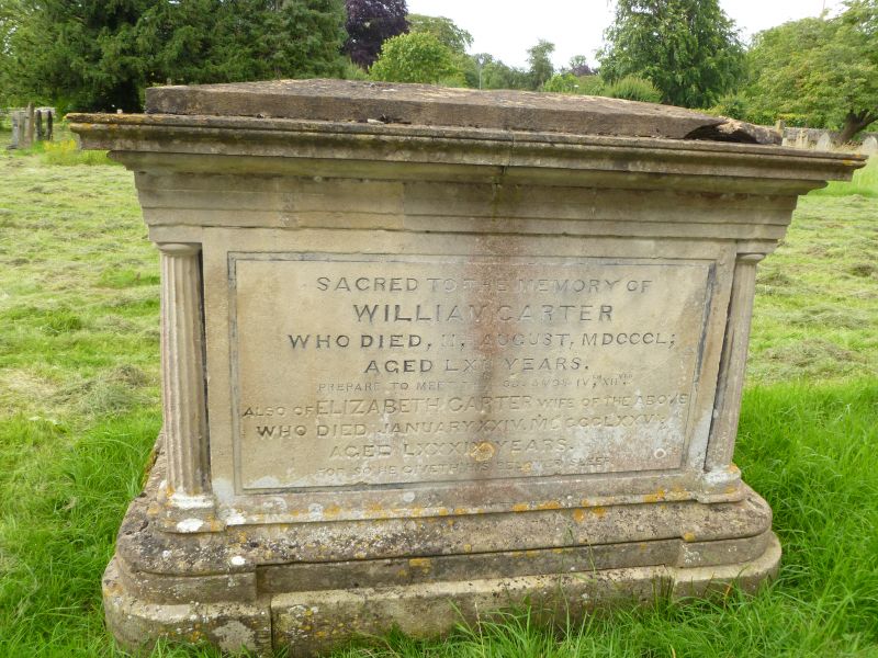
13/149 Nine monuments, including Carter
and Telling, about 17m south of
south east porch buttress, in
churchyard of Church of St. Mary
GV II
Two chest tombs: William Carter, died 1794, to north; Ann Telling
(or Tilling), died 1803, to south; and row of 7 headstones, mostly
probably to Carter family, running from west end of Carter to
beyond east end of Telling. Limestone. Carter - stepped tent top
with curved top section, moulded plinth and capping on tall base,
plain frieze, plain recessed ends with fluted returns, plain
recessed sides with narrow flanking relief strips. Telling - tent
top, moulded capping, on base. Unusual design with 4 Egyptian
caryatids to corners. Slightly fielded end and side panels. Six
headstones have high relief cartouche with cherub head and wings,
all mid to late C18. Furthest to south is smaller and plain with
initials LC and date 1797.
Listing NGR: SP1515301134
External links are from the relevant listing authority and, where applicable, Wikidata. Wikidata IDs may be related buildings as well as this specific building. If you want to add or update a link, you will need to do so by editing the Wikidata entry.


Other nearby listed buildings
