Approximate Location Map
Large Map »
Latitude: 51.9013 / 51°54'4"N
Longitude: -1.7615 / 1°45'41"W
OS Eastings: 416508
OS Northings: 222560
OS Grid: SP165225
Mapcode National: GBR 4Q6.RH7
Mapcode Global: VHB1W.FG4S
Plus Code: 9C3WW62Q+GC
Entry Name: Middle Bridge
Listing Date: 25 August 1960
Grade: II
Source: Historic England
Source ID: 1341060
English Heritage Legacy ID: 129905
ID on this website: 101341060
Location: Lower Slaughter, Cotswold, Gloucestershire, GL54
County: Gloucestershire
District: Cotswold
Civil Parish: Lower Slaughter
Traditional County: Gloucestershire
Lieutenancy Area (Ceremonial County): Gloucestershire
Church of England Parish: Lower Slaughter St Mary
Church of England Diocese: Gloucester
Tagged with: Bridge
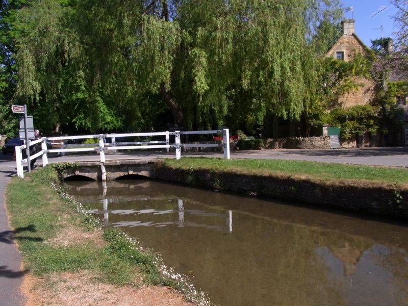
LOWER SLAUGHTER
SP 1622
10/21 Middle Bridge
25.8.60
II
Just north of Washbourne's Place. C18 or C19. Road-bridge of two low stone
rubble segmented arches with wooden handrail.
Listing NGR: SP1650822560
External links are from the relevant listing authority and, where applicable, Wikidata. Wikidata IDs may be related buildings as well as this specific building. If you want to add or update a link, you will need to do so by editing the Wikidata entry.


Other nearby listed buildings
