Approximate Location Map
Large Map »
Latitude: 51.7099 / 51°42'35"N
Longitude: -2.1924 / 2°11'32"W
OS Eastings: 386805
OS Northings: 201260
OS Grid: SO868012
Mapcode National: GBR 1MZ.QKD
Mapcode Global: VH954.Y9C0
Plus Code: 9C3VPR55+X3
Entry Name: Milestone
Listing Date: 24 March 1988
Grade: II
Source: Historic England
Source ID: 1340455
English Heritage Legacy ID: 133021
ID on this website: 101340455
Location: Minchinhampton, Stroud, Gloucestershire, GL6
County: Gloucestershire
District: Stroud
Civil Parish: Minchinhampton
Built-Up Area: Minchinhampton
Traditional County: Gloucestershire
Lieutenancy Area (Ceremonial County): Gloucestershire
Church of England Parish: Brimscombe Holy Trinity
Church of England Diocese: Gloucester
Tagged with: Milestone
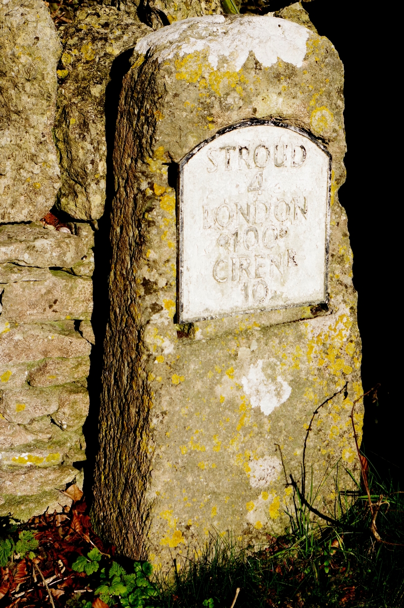
SO 8601-8701 MINCHINHAMPTON CIRENCESTER ROAD
at NGR SO 8680l13 (north side)
16/230 Milestone
II
Milestone. Early C19. Iron plate with raised Roman lettering,
border and arched top, mounted on rectangular post pith rounded
R
top. Plate reads: 'STROUD / 4 / LONDON / 100 / CIREN / 10'.
Listing NGR: SO8680501260
External links are from the relevant listing authority and, where applicable, Wikidata. Wikidata IDs may be related buildings as well as this specific building. If you want to add or update a link, you will need to do so by editing the Wikidata entry.


Other nearby listed buildings
