Approximate Location Map
Large Map »
Latitude: 51.7027 / 51°42'9"N
Longitude: -2.2991 / 2°17'56"W
OS Eastings: 379428
OS Northings: 200479
OS Grid: SO794004
Mapcode National: GBR 0LQ.7KL
Mapcode Global: VH953.3GFL
Plus Code: 9C3VPP32+39
Entry Name: Milestone
Listing Date: 24 March 1988
Grade: II
Source: Historic England
Source ID: 1152110
English Heritage Legacy ID: 133119
ID on this website: 101152110
Location: Nympsfield, Stroud, Gloucestershire, GL11
County: Gloucestershire
District: Stroud
Civil Parish: Coaley
Built-Up Area: Nympsfield
Traditional County: Gloucestershire
Lieutenancy Area (Ceremonial County): Gloucestershire
Church of England Parish: Coaley St Bartholomew
Church of England Diocese: Gloucester
Tagged with: Milestone
SO 70 SE at NYMPSFIELD B4066
NGR SO 794005 (west side)
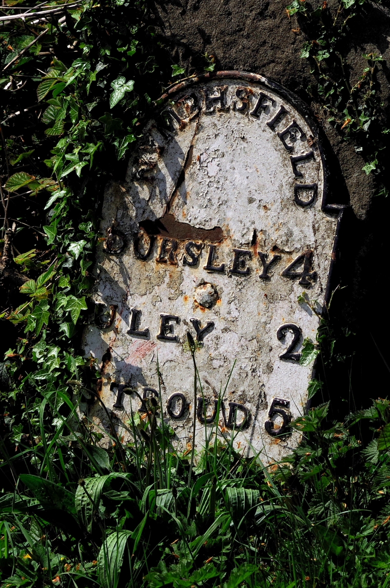
1/323 Milestone
II
Milestone. Early C19. Sandstone pillar with cast-iron plaque.
Pillar c450mm x 300mm with rounded top, cast-iron plaque c400mm x
500mm with semi-circular haunched head, carries inscription
"NYMPHSFIELD' in head, and 'DURSLEY 4 / ULEY 2 / STROUD 5' below.
Listing NGR: SO7942800479
External links are from the relevant listing authority and, where applicable, Wikidata. Wikidata IDs may be related buildings as well as this specific building. If you want to add or update a link, you will need to do so by editing the Wikidata entry.


Other nearby listed buildings
