Approximate Location Map
Large Map »
Latitude: 51.786 / 51°47'9"N
Longitude: -2.1931 / 2°11'35"W
OS Eastings: 386775
OS Northings: 209717
OS Grid: SO867097
Mapcode National: GBR 1M0.Y2G
Mapcode Global: VH94R.XCYQ
Plus Code: 9C3VQRP4+9Q
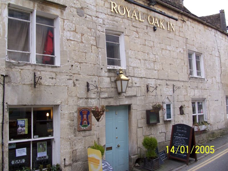
Entry Name: The Royal Oak
Listing Date: 21 October 1955
Grade: II
Source: Historic England
Source ID: 1090948
English Heritage Legacy ID: 133461
Also known as: The Royal Oak Inn
The Oak, Painswick
ID on this website: 101090948
Location: Painswick, Stroud, Gloucestershire, GL6
County: Gloucestershire
District: Stroud
Civil Parish: Painswick
Built-Up Area: Painswick
Traditional County: Gloucestershire
Lieutenancy Area (Ceremonial County): Gloucestershire
Church of England Parish: Painswick St Mary the Virgin
Church of England Diocese: Gloucester
PAINSWICK ST MARY'S STREET
SO 8609/8709 (part)
(south side)
8.274 The Royal Oak
21.10.55
GV II
Inn, formerly the Red Lion and the Royal Oaks; amalgamated 1891. C17, much
modified in C19 and C20. Coursed and squared limestone, stone slate roofs. A
long building set to curve in street; left, later half is eaves to street, but
right half has double coped gables, which are repeated on the far side.
Scattered fenestration; the left hall has a 4-pane sash, a 2-light casement and
a 4-pane fixed light; first floor has two 2-light chamfer-mullion casements, one
with stopped hood; between these a single light, then to right a 2-light wood
casement. Off-centre, left, a pair of 3-panel doors; floor level is well below
present paving level. The double gabled unit, right, was formerly a separate
inn, has 2-light chamfer mullion casement above a loading door about 2 m above
the pavement, with plank door - this is assumed to have been formerly a window.
At eaves to left a stack, and two small stacks at ridge, right. The far side of
the building has a small paved courtyard adjacent to Loveday's Garden (q.v.) and
to left the double-gabled unit has 2 or 3-light stone mullioned casements.
Listing NGR: SO8677509717
External links are from the relevant listing authority and, where applicable, Wikidata. Wikidata IDs may be related buildings as well as this specific building. If you want to add or update a link, you will need to do so by editing the Wikidata entry.


Other nearby listed buildings
