Approximate Location Map
Large Map »
Latitude: 50.9204 / 50°55'13"N
Longitude: -1.4152 / 1°24'54"W
OS Eastings: 441200
OS Northings: 113599
OS Grid: SU412135
Mapcode National: GBR RP3.RZ
Mapcode Global: FRA 76XN.Y7F
Plus Code: 9C2WWHCM+5W
Entry Name: Wall to Southampton Old Cemetery Fronting Hill Lane
Listing Date: 8 October 1981
Grade: II
Source: Historic England
Source ID: 1339993
English Heritage Legacy ID: 135791
ID on this website: 101339993
Location: Banister's Park, Southampton, Hampshire, SO15
County: City of Southampton
Electoral Ward/Division: Shirley
Parish: Non Civil Parish
Built-Up Area: Southampton
Traditional County: Hampshire
Lieutenancy Area (Ceremonial County): Hampshire
Tagged with: Wall
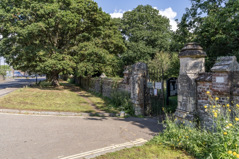
1. CEMETERY ROAD
5239
Wall to Southampton
Old Cemetery fronting
Hill Lane
SU 41 SW 10/99
II
2.
Mid C19 wall of coursed rubble about 5 ft in height with red brick coping
and piers at regular intervals.
Listing NGR: SU4255313582
External links are from the relevant listing authority and, where applicable, Wikidata. Wikidata IDs may be related buildings as well as this specific building. If you want to add or update a link, you will need to do so by editing the Wikidata entry.


Other nearby listed buildings
