Approximate Location Map
Large Map »
Latitude: 50.91 / 50°54'36"N
Longitude: -1.408 / 1°24'28"W
OS Eastings: 441717
OS Northings: 112448
OS Grid: SU417124
Mapcode National: GBR RQ3.C8
Mapcode Global: FRA 76YP.M9T
Plus Code: 9C2WWH6R+2Q
Entry Name: 8 and 9, Cumberland Place
Listing Date: 8 October 1981
Grade: II
Source: Historic England
Source ID: 1302274
English Heritage Legacy ID: 135808
ID on this website: 101302274
Location: Polygon, Southampton, Hampshire, SO15
County: City of Southampton
Electoral Ward/Division: Bargate
Parish: Non Civil Parish
Built-Up Area: Southampton
Traditional County: Hampshire
Lieutenancy Area (Ceremonial County): Hampshire
Church of England Parish: Southampton City Centre St Mary
Church of England Diocese: Winchester
Tagged with: Building
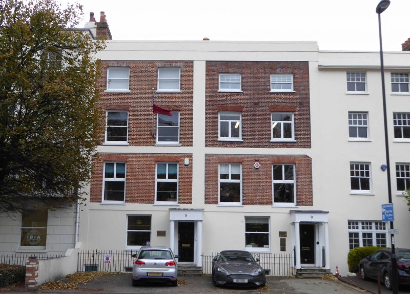
1. CUMBERLAND PLACE
5239
Nos 8 and 9
SU 4112 1/114
II GV
2.
Mid C19 pair. Four storeys and basement red brick with stuccoed parapet concealing
roof. Pilasters. Bands between 2 lower floors. Two sashes each without
glazing bars. Doric porticoes. Included for group value.
Listing NGR: SU4171312448
External links are from the relevant listing authority and, where applicable, Wikidata. Wikidata IDs may be related buildings as well as this specific building. If you want to add or update a link, you will need to do so by editing the Wikidata entry.


Other nearby listed buildings
