Approximate Location Map
Large Map »
Latitude: 50.8989 / 50°53'56"N
Longitude: -1.4035 / 1°24'12"W
OS Eastings: 442045
OS Northings: 111216
OS Grid: SU420112
Mapcode National: GBR RQV.JD
Mapcode Global: FRA 76YQ.P1F
Plus Code: 9C2WVHXW+HJ
Entry Name: 56, High Street
Listing Date: 8 October 1981
Grade: II
Source: Historic England
Source ID: 1339963
English Heritage Legacy ID: 135836
ID on this website: 101339963
Location: Southampton, Hampshire, SO14
County: City of Southampton
Electoral Ward/Division: Bargate
Parish: Non Civil Parish
Built-Up Area: Southampton
Traditional County: Hampshire
Lieutenancy Area (Ceremonial County): Hampshire
Church of England Parish: Southampton City Centre St Mary
Church of England Diocese: Winchester
Tagged with: Building
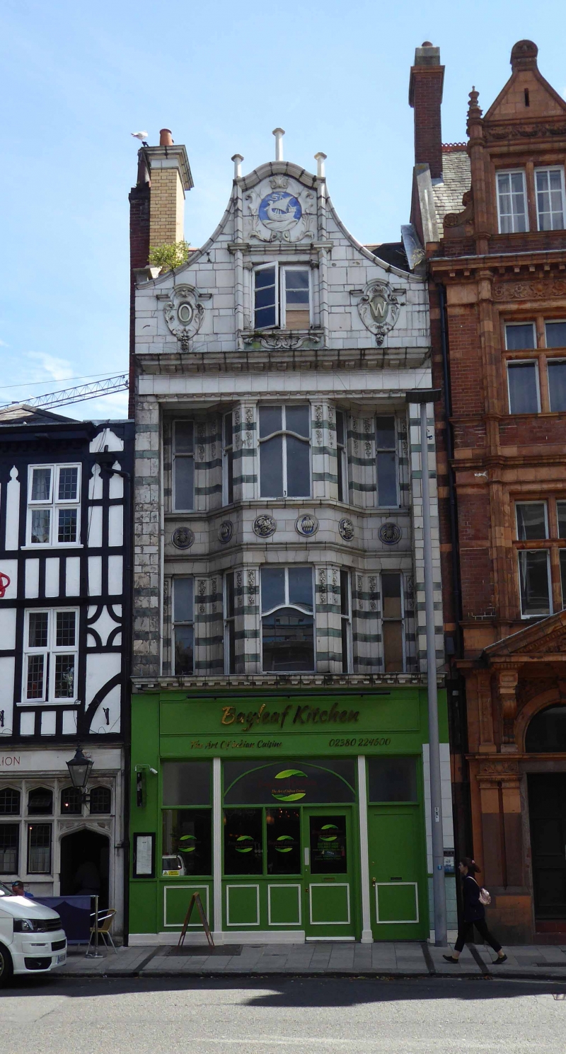
1. HIGH STREET
5239 (east side)
No 56
SU 4211 4/139
II GV
2.
Circa 1890. Flemish style. Faced with glazed ceramic tiles. Roof concealed
by elaborate curved pediment. Wide bracket eaves cornice. Three light canted
bay through first and second floors. Modern shop-front.
Listing NGR: SU4206511215
External links are from the relevant listing authority and, where applicable, Wikidata. Wikidata IDs may be related buildings as well as this specific building. If you want to add or update a link, you will need to do so by editing the Wikidata entry.


Other nearby listed buildings
