Approximate Location Map
Large Map »
Latitude: 50.9097 / 50°54'34"N
Longitude: -1.4101 / 1°24'36"W
OS Eastings: 441569
OS Northings: 112412
OS Grid: SU415124
Mapcode National: GBR RPV.XG
Mapcode Global: FRA 76YP.SJV
Plus Code: 9C2WWH5Q+VX
Entry Name: 21, the Polygon
Listing Date: 8 October 1981
Grade: II
Source: Historic England
Source ID: 1091991
English Heritage Legacy ID: 135885
ID on this website: 101091991
Location: Polygon, Southampton, Hampshire, SO15
County: City of Southampton
Electoral Ward/Division: Bargate
Parish: Non Civil Parish
Built-Up Area: Southampton
Traditional County: Hampshire
Lieutenancy Area (Ceremonial County): Hampshire
Church of England Parish: Southampton City Centre St Mary
Church of England Diocese: Winchester
Tagged with: Building
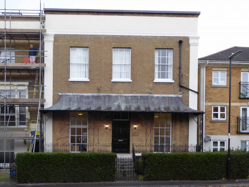
1. THE POLYGON
5239
No 21
SU 4112 1/193
II
2.
Circa 1840. Two storeys yellow brick. Parapet and cement coping. Two pilasters
running the whole height of the building. Three sashes with glazing bars.
The ground floor has a tent-shaped canopy with cast iron railings.
Listing NGR: SU4255313582
External links are from the relevant listing authority and, where applicable, Wikidata. Wikidata IDs may be related buildings as well as this specific building. If you want to add or update a link, you will need to do so by editing the Wikidata entry.


Other nearby listed buildings
