Approximate Location Map
Large Map »
Latitude: 50.899 / 50°53'56"N
Longitude: -1.4067 / 1°24'24"W
OS Eastings: 441816
OS Northings: 111222
OS Grid: SU418112
Mapcode National: GBR RQC.LG
Mapcode Global: FRA 76YQ.MSF
Plus Code: 9C2WVHXV+H8
Entry Name: 9 and 10, Westgate Street
Listing Date: 14 February 1969
Grade: II
Source: Historic England
Source ID: 1091988
English Heritage Legacy ID: 135972
ID on this website: 101091988
Location: Southampton, Hampshire, SO14
County: City of Southampton
Electoral Ward/Division: Bargate
Parish: Non Civil Parish
Built-Up Area: Southampton
Traditional County: Hampshire
Lieutenancy Area (Ceremonial County): Hampshire
Church of England Parish: Southampton City Centre St Mary
Church of England Diocese: Winchester
Tagged with: Building
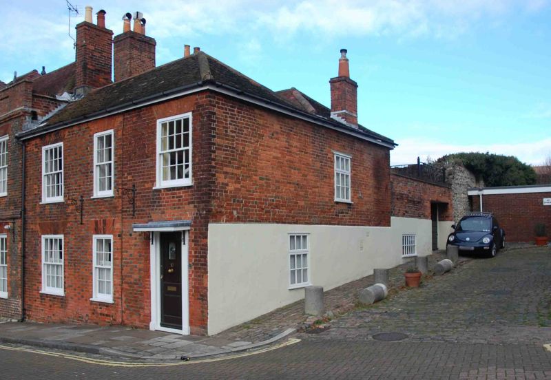
1. WESTGATE STREET
5239
Nos 9 and 10
SU 4111 3/273 14.2.69
II GV
2.
Now one house. Early C19. Two storeys red brick. Hipped old tiled roof.
Three sashes with glazing bars intact. No lo has a restored doorcase with
cornice, console brackets and pilasters.
Listing NGR: SU4181811222
External links are from the relevant listing authority and, where applicable, Wikidata. Wikidata IDs may be related buildings as well as this specific building. If you want to add or update a link, you will need to do so by editing the Wikidata entry.


Other nearby listed buildings
