Approximate Location Map
Large Map »
Latitude: 51.2552 / 51°15'18"N
Longitude: -0.9348 / 0°56'5"W
OS Eastings: 474432
OS Northings: 151204
OS Grid: SU744512
Mapcode National: GBR C86.BGJ
Mapcode Global: VHDXS.RQ55
Plus Code: 9C3X7348+33
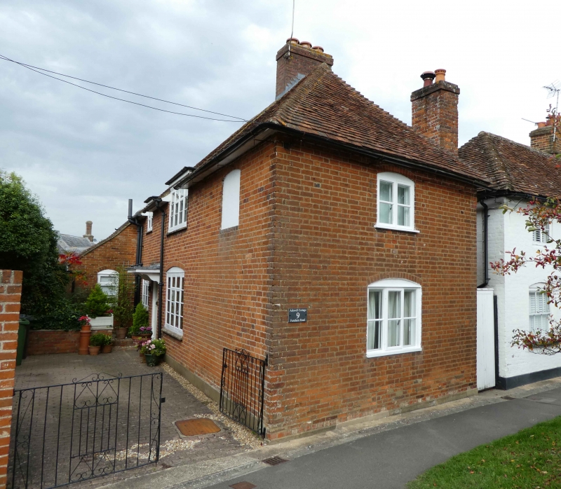
Entry Name: 9, Farnham Road
Listing Date: 26 June 1987
Grade: II
Source: Historic England
Source ID: 1339917
English Heritage Legacy ID: 136946
ID on this website: 101339917
Location: Odiham, Hart, Hampshire, RG29
County: Hampshire
District: Hart
Civil Parish: Odiham
Built-Up Area: Odiham
Traditional County: Hampshire
Lieutenancy Area (Ceremonial County): Hampshire
Church of England Parish: Odiham All Saints
Church of England Diocese: Winchester
Tagged with: Building
SU 73-7450 & 73-7451 ODIHAM FARNHAM ROAD
17/44 No 9
-
GV II
Late C18. 2 storeys, 1 window (in gable to road). Hipped tile roof, red brick-
work with cambered openings. Casements. Entrance in rear extension. Included
for group value.
Listing NGR: SU7443351207
External links are from the relevant listing authority and, where applicable, Wikidata. Wikidata IDs may be related buildings as well as this specific building. If you want to add or update a link, you will need to do so by editing the Wikidata entry.


Other nearby listed buildings
