Approximate Location Map
Large Map »
Latitude: 51.2614 / 51°15'41"N
Longitude: -0.9615 / 0°57'41"W
OS Eastings: 472557
OS Northings: 151874
OS Grid: SU725518
Mapcode National: GBR C7Z.XBR
Mapcode Global: VHDXS.9K1C
Plus Code: 9C3X726Q+H9
Entry Name: Odiham Castle
Listing Date: 24 November 1961
Grade: I
Source: Historic England
Source ID: 1092165
English Heritage Legacy ID: 136964
ID on this website: 101092165
Location: North Warnborough, Hart, Hampshire, RG29
County: Hampshire
District: Hart
Civil Parish: Odiham
Traditional County: Hampshire
Lieutenancy Area (Ceremonial County): Hampshire
Church of England Parish: Odiham All Saints
Church of England Diocese: Winchester
Tagged with: Castle
SU 75 SW ODIHAM
8/49 Odiham Castle
24.11.61
- I
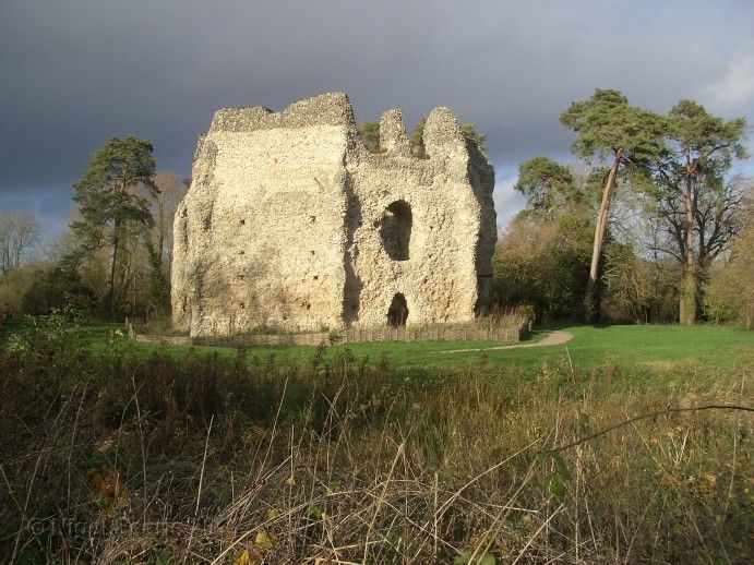
Partly-surviving octagonal keep, said to have been constructed by King John,
located within a moated area. Flint walling with stone dressings, rising up
to 3 storeys. Scheduled Ancient Monument.
Listing NGR: SU7488150603
External links are from the relevant listing authority and, where applicable, Wikidata. Wikidata IDs may be related buildings as well as this specific building. If you want to add or update a link, you will need to do so by editing the Wikidata entry.


Other nearby listed buildings
