Approximate Location Map
Large Map »
Latitude: 51.2535 / 51°15'12"N
Longitude: -0.9446 / 0°56'40"W
OS Eastings: 473750
OS Northings: 151015
OS Grid: SU737510
Mapcode National: GBR C86.80V
Mapcode Global: VHDXS.KRZD
Plus Code: 9C3X7334+C5
Entry Name: Priory Lodge
Listing Date: 26 June 1987
Grade: II
Source: Historic England
Source ID: 1272546
English Heritage Legacy ID: 137019
ID on this website: 101272546
Location: Odiham, Hart, Hampshire, RG29
County: Hampshire
District: Hart
Civil Parish: Odiham
Built-Up Area: Odiham
Traditional County: Hampshire
Lieutenancy Area (Ceremonial County): Hampshire
Church of England Parish: Odiham All Saints
Church of England Diocese: Winchester
Tagged with: Gatehouse
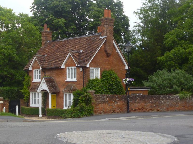
SU 73-7450 & 73-7451 ODIHAM HIGH STREET
(north side)
17/1
No 182 (Priory Lodge)
-
- II
Mid C19. Tudor/Gothic cottage of 2 storeys, 2 windows. Red tile roof, 2
gablets. Red brickwork. Pointed 3-light casements above small angular bays
(with tiled roof). 6-flush-panelled door within open porch on columns, the
gable to the tiled roof having pierced ornament and curved lower edge.
Listing NGR: SP7320261059
External links are from the relevant listing authority and, where applicable, Wikidata. Wikidata IDs may be related buildings as well as this specific building. If you want to add or update a link, you will need to do so by editing the Wikidata entry.


Other nearby listed buildings
