Approximate Location Map
Large Map »
Latitude: 51.319 / 51°19'8"N
Longitude: -1.22 / 1°13'11"W
OS Eastings: 454455
OS Northings: 158056
OS Grid: SU544580
Mapcode National: GBR 94D.BC7
Mapcode Global: VHCZZ.S3XP
Plus Code: 9C3W8Q9J+J2
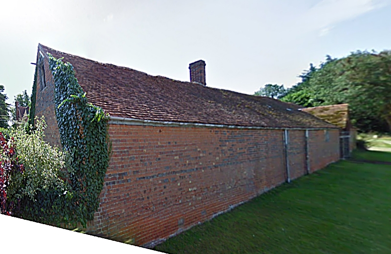
Entry Name: Cartshed 40 Yards West of the Old House
Listing Date: 18 May 1984
Grade: II
Source: Historic England
Source ID: 1339715
English Heritage Legacy ID: 137983
ID on this website: 101339715
Location: Wolverton, Basingstoke and Deane, Hampshire, RG26
County: Hampshire
District: Basingstoke and Deane
Civil Parish: Kingsclere
Traditional County: Hampshire
Lieutenancy Area (Ceremonial County): Hampshire
Church of England Parish: Wolverton with Ewhurst St Catherine
Church of England Diocese: Winchester
Tagged with: Carriage house
SU 55 NW BAUGHURST RECTORY LANE
8/33
Cartshed 40 yds west
of The Old House
II
Early C19. Timber frame of 5 bays, with Queen post trusses. Hipped pantile roof,
walls partly boarded, some brickwork and some corrugated iron cladding.
Listing NGR: SU5665359212
External links are from the relevant listing authority and, where applicable, Wikidata. Wikidata IDs may be related buildings as well as this specific building. If you want to add or update a link, you will need to do so by editing the Wikidata entry.


Other nearby listed buildings
