Approximate Location Map
Large Map »
Latitude: 51.3408 / 51°20'26"N
Longitude: -1.2424 / 1°14'32"W
OS Eastings: 452869
OS Northings: 160462
OS Grid: SU528604
Mapcode National: GBR 93Z.YJ2
Mapcode Global: VHCZS.FK2H
Plus Code: 9C3W8QR5+83
Entry Name: Upper House Farmhouse
Listing Date: 18 May 1984
Grade: II
Source: Historic England
Source ID: 1092464
English Heritage Legacy ID: 138266
ID on this website: 101092464
Location: Basingstoke and Deane, Hampshire, RG20
County: Hampshire
District: Basingstoke and Deane
Civil Parish: Kingsclere
Traditional County: Hampshire
Lieutenancy Area (Ceremonial County): Hampshire
Church of England Parish: Kingsclere
Church of England Diocese: Winchester
Tagged with: Farmhouse
SU 56 SW KINGSCLERE UNION LANE
3/37
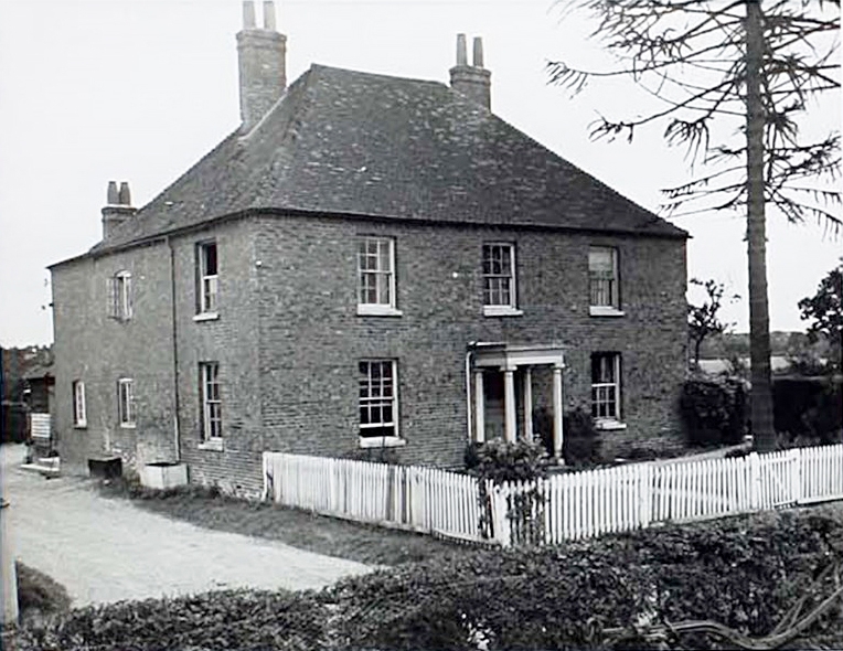
Upper House Farmhouse
II
Early C19. Symmetrical front (west) of 2 storeys, 3 windows. Hipped tile roof, brick
dentil eaves. Blue and brindle brick walling in Flemish bond, Dutch flat arches,
stone cills. Sashes in reveals. Tuscan porch of simple form, with a fanlight above a
recent half-glazed door.
Listing NGR: SU5283757840
External links are from the relevant listing authority and, where applicable, Wikidata. Wikidata IDs may be related buildings as well as this specific building. If you want to add or update a link, you will need to do so by editing the Wikidata entry.


Other nearby listed buildings
