Approximate Location Map
Large Map »
Latitude: 51.2127 / 51°12'45"N
Longitude: -1.1971 / 1°11'49"W
OS Eastings: 456175
OS Northings: 146250
OS Grid: SU561462
Mapcode National: GBR 95L.XVJ
Mapcode Global: VHD0D.6SG6
Plus Code: 9C3W6R73+34
Entry Name: Thatchings
Listing Date: 17 October 1984
Grade: II
Source: Historic England
Source ID: 1092932
English Heritage Legacy ID: 138785
ID on this website: 101092932
Location: North Waltham, Basingstoke and Deane, Hampshire, RG25
County: Hampshire
District: Basingstoke and Deane
Civil Parish: North Waltham
Built-Up Area: North Waltham
Traditional County: Hampshire
Lieutenancy Area (Ceremonial County): Hampshire
Church of England Parish: North Waltham St Michael
Church of England Diocese: Winchester
Tagged with: Building Thatched cottage
SU 54 NE NORTH WALTHAM CHURCH ROAD
14/14
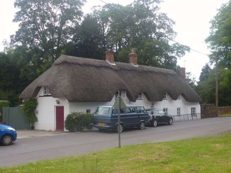
Thatchings
II
C18. Long range now one dwelling; one-storey and attic, 6 ground-floor windows.
Hipped thatch roof with eyebrows. Painted walling of brickwork, but some flint at the
east side, small casements. Boarded door in solid frame.
Listing NGR: SP5617646247
External links are from the relevant listing authority and, where applicable, Wikidata. Wikidata IDs may be related buildings as well as this specific building. If you want to add or update a link, you will need to do so by editing the Wikidata entry.


Other nearby listed buildings
