Approximate Location Map
Large Map »
Latitude: 51.3095 / 51°18'34"N
Longitude: -1.0863 / 1°5'10"W
OS Eastings: 463783
OS Northings: 157110
OS Grid: SU637571
Mapcode National: GBR B5X.VK3
Mapcode Global: VHD02.4B2Y
Plus Code: 9C3W8W57+RF
Entry Name: Garden Walls
Listing Date: 26 April 1957
Grade: II
Source: Historic England
Source ID: 1092828
English Heritage Legacy ID: 139040
ID on this website: 101092828
Location: Basingstoke and Deane, Hampshire, RG24
County: Hampshire
District: Basingstoke and Deane
Civil Parish: Sherborne St John
Traditional County: Hampshire
Lieutenancy Area (Ceremonial County): Hampshire
Church of England Parish: The Sherbornes with Pamber
Church of England Diocese: Winchester
Tagged with: Wall
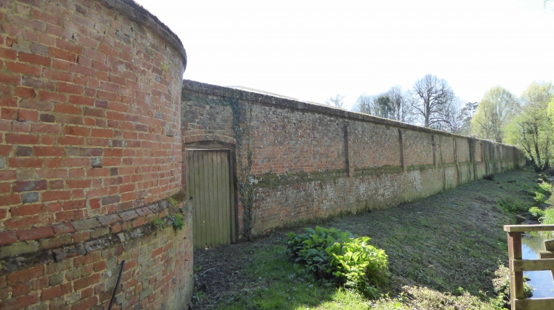
SU 65 NW SHERBORNE ST JOHN VYNE PARK
5/86
26.4.57 Garden Walls
II
C18. High red brick wall encircling a kitchen garden south of the North Lodge.
Weathered top, regular buttresses merging with a plinth. Stone vases at the corners of
the south wall.
Listing NGR: SU6271556115
External links are from the relevant listing authority and, where applicable, Wikidata. Wikidata IDs may be related buildings as well as this specific building. If you want to add or update a link, you will need to do so by editing the Wikidata entry.


Other nearby listed buildings
