Approximate Location Map
Large Map »
Latitude: 51.2062 / 51°12'22"N
Longitude: -1.4784 / 1°28'42"W
OS Eastings: 436538
OS Northings: 145349
OS Grid: SU365453
Mapcode National: GBR 72R.C1R
Mapcode Global: VHC2S.BY96
Plus Code: 9C3W6G4C+FM
Entry Name: The Foresters Arms
Listing Date: 24 June 1983
Grade: II
Source: Historic England
Source ID: 1236436
English Heritage Legacy ID: 139528
Also known as: Foresters Arms, Andover
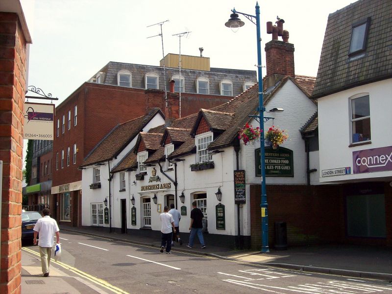
Foresters Arms
ID on this website: 101236436
Location: Andover, Test Valley, Hampshire, SP10
County: Hampshire
District: Test Valley
Civil Parish: Andover
Built-Up Area: Andover
Traditional County: Hampshire
Lieutenancy Area (Ceremonial County): Hampshire
Church of England Parish: Andover St Mary
Church of England Diocese: Winchester
Tagged with: Pub
SU 3645 SE ANDOVER LONDON STREET
4/70 The Foresters Arms
II
C18, early Cl9. Irregular range of 2 storeys and one storey with attic, 1.4 upper
windows. Tile roofing, brick dentil eaves to the higher east side, gabled
half-dormers with decorative tile front. Painted stucco walling. Wide sashes 2 plain
doors.
Listing NGR: SU3653845349
External links are from the relevant listing authority and, where applicable, Wikidata. Wikidata IDs may be related buildings as well as this specific building. If you want to add or update a link, you will need to do so by editing the Wikidata entry.


Other nearby listed buildings
