Approximate Location Map
Large Map »
Latitude: 51.1974 / 51°11'50"N
Longitude: -1.3839 / 1°23'2"W
OS Eastings: 443142
OS Northings: 144425
OS Grid: SU431444
Mapcode National: GBR 846.YQF
Mapcode Global: VHC30.Y5QD
Plus Code: 9C3W5JW8+XC
Entry Name: Granary (15 Yards North of Malthouse Cottage)
Listing Date: 21 March 1984
Grade: II
Source: Historic England
Source ID: 1339295
English Heritage Legacy ID: 139678
ID on this website: 101339295
Location: Longparish, Test Valley, Hampshire, SP11
County: Hampshire
District: Test Valley
Civil Parish: Longparish
Traditional County: Hampshire
Lieutenancy Area (Ceremonial County): Hampshire
Church of England Parish: Longparish St Nicholas
Church of England Diocese: Winchester
Tagged with: Granary Thatched building
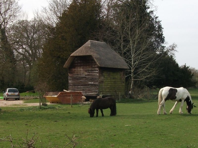
SW 44 SW LONGPARISH LONGPARISH
4/12 Granary (15 Yards North
of Malthouse Cottage)
GV II
Small granary. Early c19. Timber frame on staddles, with boarded walls and
½-hipped thatch roof.
Listing NGR: SU4266743930
External links are from the relevant listing authority and, where applicable, Wikidata. Wikidata IDs may be related buildings as well as this specific building. If you want to add or update a link, you will need to do so by editing the Wikidata entry.


Other nearby listed buildings
