Approximate Location Map
Large Map »
Latitude: 51.113 / 51°6'46"N
Longitude: -1.4878 / 1°29'16"W
OS Eastings: 435947
OS Northings: 134978
OS Grid: SU359349
Mapcode National: GBR 73X.2NL
Mapcode Global: VHC3C.5994
Plus Code: 9C3W4G76+5V
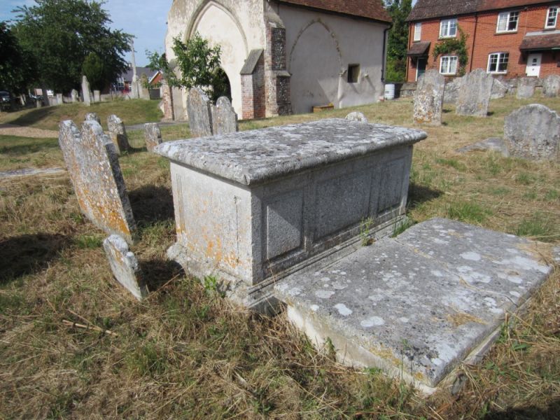
Entry Name: Tombchest to William Bealmont 20 Metres South West of Church
Listing Date: 27 November 1984
Grade: II
Source: Historic England
Source ID: 1178525
English Heritage Legacy ID: 140395
ID on this website: 101178525
Location: Old St Peter's Church, Stockbridge, Test Valley, Hampshire, SO20
County: Hampshire
District: Test Valley
Civil Parish: Stockbridge
Built-Up Area: Stockbridge
Traditional County: Hampshire
Lieutenancy Area (Ceremonial County): Hampshire
Church of England Parish: Stockbridge St Peter
Church of England Diocese: Winchester
Tagged with: Tomb
SU 33 NE STOCKBRIDGE STOCKBRIDGE
(south side)
7/1 Tombchest to William Beal-
mont 20m SW of church
GV II
Tombchest. 1791 to William Bealmont. Portland stone.
Listing NGR: SU3549935143
External links are from the relevant listing authority and, where applicable, Wikidata. Wikidata IDs may be related buildings as well as this specific building. If you want to add or update a link, you will need to do so by editing the Wikidata entry.


Other nearby listed buildings
