Approximate Location Map
Large Map »
Latitude: 51.1404 / 51°8'25"N
Longitude: 1.3419 / 1°20'30"E
OS Eastings: 633866
OS Northings: 143210
OS Grid: TR338432
Mapcode National: GBR X2T.J2G
Mapcode Global: VHLHC.6LRN
Plus Code: 9F3348RR+4Q
Entry Name: Receiver site and Royal Observer Corps Underground Nuclear Monitoring Post, former Swingate Chain Home Radar Station
Listing Date: 13 July 2012
Grade: II
Source: Historic England
Source ID: 1405533
ID on this website: 101405533
Location: Dover, Kent, CT15
County: Kent
District: Dover
Civil Parish: St. Margaret's at Cliffe
Traditional County: Kent
Lieutenancy Area (Ceremonial County): Kent
Tagged with: Architectural structure Royal Observer Corps Monitoring Post Radar station
Receiver site to the former Swingate Chain Home Radar Station, 1936-8, comprising Receiver building, 3 receiver mast bases and an Interrogation Friend or Foe (IFF) cubicle. Also a Royal Observer Corps (ROC) Underground Nuclear Monitoring Post, 1962.
Swingate Radar Station is built on a prominent site above the cliffs about 2km to the north-east of Dover town, centred on grid reference TR 33680 43077. The site is large (approximately 21ha) and consists of a transmitter site, receiver site, and ancillary structures. The transmitter site and buried reserve site are separately listed.
RECEIVER SITE
The receiver site (which is redundant and farmed) is located to the north-east of the transmitter site at TR 33862 43220 and comprises a receiver building, historically located roughly in the centre of a trapezoidal enclosure. The receiver towers, which were wooden self-supporting 240-foot towers (designed by Mr Norman Garnish of the Air Ministry) on concrete footings, have all been demolished but the footings of three out of four survive (see below). There are historic photographs which show the towers in situ. An associated pair of semi-detached houses at the west entrance to the receiver site, one of which is presumed to have been the former married quarters for the site warden, were demolished many years ago. Close to the western boundary of the receiver site, but within the area of the original trapezoidal enclosure is a Royal Observer Corps (ROC) post.
RECEIVER BUILDING (TR 33862 43220)
The receiver building is a protected ‘A’ type receiver block. It is a rectangular structure approximately 18m long by 9m wide and oriented north-south. It is externally rendered in part, largely where there is an external traverse (see below), but elsewhere the red brick, English bond construction is visible although some sections of parapet are in Stretcher bond, presumably re-built. A deep parapet conceals a flat roof which is constructed of reinforced concrete. This roof space, in common with other receiver buildings, would have been filled with shingle to a depth of circa 1.7m to disperse any blast and sealed with a bitumen type material, which is visible here. There are drainage holes through the parapet wall. Externally the building has a number of windows and doors with concrete lintels, some with surviving timber frames; other openings have been bricked up. There are also air-bricks providing ventilation to the walls and some air conditioning extractor hoods.
Receiver buildings usually had a surrounding earth traverse for blast protection. This survives here except in the northern part of the east elevation where the presence of a large detached concrete block, of unknown function and with iron fittings exposed on its upper side, suggests that the traverse may have been deliberately omitted at this point. The earth traverse is reveted by a low yellow brick wall externally and a high concrete wall internally, creating a covered way around the building. The main entrance, to the east, has a dog-leg defended and hardened entrance with reinforced concrete blast walls. The entrance here is through a modern pair of metal security doors. There is a further protected entrance to the north.
The interior is divided into a number of rooms, not all of which could be inspected. However, as the layout of early receiver buildings followed a standardised form (built to Air Ministry drawing 4238/38) it is clear that these included a lobby, office, receiver room, calculator room, plant room, switch gear room, transformer cubicle and WC. The original colour scheme of pale blue to dado rail height and cream/yellow paint above survives as do a number of simple wooden architraves. There is a wide cable pit, which housed the cables from the receiver towers, running through the centre of the building. What is most surprising is the amount of fixtures and fittings that survive, given that the building is derelict, including lights and light switches, ceiling brackets (indicating the original position of cable trays), a water tank, a switch gear rack and various electrical circuit boxes. One panel has the maker’s name, ‘Allen West & Co Brighton England’, also observed in the transmitter building. These are of some antiquity but are not primary phase fittings; they probably date to the early Cold War era.
RECEIVER TOWER BASES
There are also surviving bases for three of the four receiver towers. All of the original timber towers have been removed and the north-east tower base was demolished in circa 2000. The surviving bases are located to the north-west of the receiver building at TR 33779 43224, and two to the south of the receiver building at TR 33866 43195 and TR 33873 43052. Each comprises four concrete ‘feet’ which are square in plan (approximately 3m2) and are slightly tapering blocks to a maximum height of 2.10m.
ROYAL OBSERVER CORPS (ROC) - UNDERGROUND NUCLEAR MONITORING POST (TR 33779 43224)
The ROC post is built of reinforced concrete. Above ground, there is an access hatch to the south with a heavy ‘Broads Pattern’ iron hatch cover and an air vent to the north. The structure is entered through the hatch with a vertical wall-fixed metal ladder leading down into a small ante-room beneath, off which is a WC. The main chamber is to the north, the concrete walls of which are chamfered at the ceiling. The green-painted, solid timber plank doors to the main chamber and WC survive, as does the toilet and seat, a cupboard and fold-down table in the main chamber, light fittings and electrics. Some portable items, such as a bucket and batteries, were present when inspected in 2010. There is a metal vent cover high in the north wall and a drainage grill in the floor of the ante-room.
A site visit by Subterranea Britannica in 2004 recorded that many more of its internal furnishings, including bunk beds, a single bed and mattresses, but these were no longer in situ when inspected in 2010.
IDENTIFICATION FRIEND OR FOE (IFF) CUBICLE (TR 33811 43094)
This small structure is located against the western boundary of the receiver site to the south-west of the receiver building. Although its brickwork has been patched, the original fabric, which appears of Second World War date, is of yellow brick English bond. To the north is the small cubicle which has a flat concrete roof, the west wall of which extends to the south to create a protected east entrance. There are remains of the cubicle’s wooden door frame as well as a metal rack inside. Overgrown concrete footings to the immediate east of this cubicle may relate to the IFF but their form and function cannot be discerned.
The principles behind radar were widely recognised by the 1930s, but British technicians were the first to translate the science – that an electromagnetic pulse reflected from an object betrays that object’s position to a receiver – into a practical means of defence. Following experimental work at Orfordness and Bawdsey Research Station in Suffolk (which became the prototype site for the Chain Home Defence System and where different components are listed Grade II and II*), radar developed through the initial Home Chain, a small group of stations in the extreme south-east of the country, to Chain Home Low, which filled the gaps in low-looking cover left by the original technology. Both were designed for raid reporting, passing information to a central operations room which in turn directed fighters to intercept enemy aircraft. This system was to prove vital during the Battle of Britain. Radar was then adapted during the Blitz of 1940-1 to incorporate a system of Ground Controlled Interception by which night fighters were controlled directly by each station rather than via a central operations room. A further addition in 1941 was Coast Defence/Chain Home Low, a low-cover coastal radar designed to detect surface shipping. Many stations were converted in 1942 to new and more powerful equipment, known as Chain Home Extra Low. Finally, in 1943, Fighter Direction radar was developed to aid Fighter Command in their offensive sweeps over occupied Europe. Many radar stations were reused during the Cold War period for Rotor, a Cold War re-engineering of wartime radar equipment and later replacement with new designs.
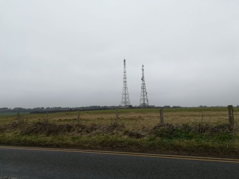
Swingate Chain Home Radar Station (also sometimes referred to as Dover Radar Station) was one of the earliest of the initial Home Chain of which there were eventually 32 sites nationally. It is believed to have been the second built nationally after the experimental prototype station at Bawdsey. Radar sites of this early pre-war period were essentially divided in two with one part of the site housing receiver functions and the other transmitter functions. The layout of the receiver and transmitter buildings relative to their towers was different and therefore aids identification. The receiver towers were arranged in a broadly square plan with the receiver building at the centre, whereas the towers of the transmitter site were arranged in a line. Information would be passed to Fighter Group HQ at RAF Bentley Priory where enemy aircraft locations were plotted and a response was co-ordinated. With a range of approximately 150 miles above the ‘radar horizon’, Chain Home stations were a vital part of the country’s defence.
Work began at Swingate in 1936 and although substantially complete by May 1937 was finally completed in the summer of 1938 as part of the first group of five radar stations nationally. These had been planned in 1935 and developed between 1936-8 and were known as the Estuary Chain Home group (the others being the aforementioned Bawdsey site in Suffolk and new sites at Great Bromley in Essex, Canewdon and Dunkirk in Kent.) Until the permanent site was ready, temporary equipment was installed. The site, in common with other radar stations, would also have had a building to house the stand-by generator set house protected by a traverse. At Swingate this is believed to be located at grid reference TR 33683 42878 where concrete footings or capping can just be observed through heavy undergrowth. However, the vegetation has precluded a firm identification at the present time. A guard-hut would also have been the norm: the Swingate guard hut was at the entrance to the receiver site but does not survive. The buried reserve, an addition to sites planned in late 1939 to allow them to function in the event that the main station was bombed and out of action, was operational at Swingate from July 1941. A further development was the installation of an Identification Friend or Foe system (IFF, developed in 1939) to allow the site to differentiate between friendly and enemy aircraft. This was located in a small cubicle on the receiver site. In common with other south-eastern stations Swingate came under Fighter Command’s strategically important 11 Group (a division of Fighter Command covering London and the south-east). It was identified by the War Office as Vulnerable Point No 125, a site vulnerable to enemy attack, and therefore defensive structures were added.
Swingate also became one of the Gee Chain navigation stations, using a development of radar equipment, working to improve the accuracy of bombing raids in the early 1940s.
Some sources erroneously suggest that the site housed equipment in early 1940 as part of the Chain Home Low system, allowing the detection of lower-flying aircraft than Chain Home could detect. In fact the nearest CHL station at Fan Bay approximately ¾ mile to the south-east. (Confusion arises as the name 'Swingate' is sometimes used for the radar station, and sometimes to refer to the wider area.), and RAF Swingate would also have been the parent site to the CHL site. In 1944-5 the station was also provided with Cathode-ray direction-finding (CRDF) equipment to detect V2 missile launches (known as Operation Big Ben).
The Swingate towers were prominent on the coast and were investigated by the Graf Zeppelin II in 1938/9 and also inspected by Goering through binoculars while on a visit to France. Initially the Germans did not fully appreciate the significance and function of these new coastal structures. This changed on 12-13 August 1940 when the site and others along the south coast were attacked in an attempt by the Luftwaffe to disrupt transmissions and destroy them, as a part of the long-planned attack known as ‘Adlertag’ or ‘Eagle Day’. Radar stations were a key target with Swingate, Pevensey, Ventnor, Dunkirk and Rye all damaged to varying degrees. The bombing at Swingate damaged one of the towers as well as hutting on site, but operations continued albeit with some reliance on emergency equipment. Damage to radar stations allowed the Luftwaffe to successfully attack a number of key airfields in southern England such as Hawkinge, Manston, Eastchurch and Detling and they also attacked other military targets including an aircraft factory in Rochester. Swingate was attacked on numerous occasions during the war and a particularly atmospheric photograph survives showing it under shell attack on 29 April 1941.
The site was modified during the Cold War. Although sometimes recorded as being a Rotor site, the early warning system of the early 1950s, the new Rotor equipment was actually housed at St Margaret’s Bay (to the north-east of Swingate and now demolished), although Swingate’s re-engineered equipment was operational in the long-range early warning role as part of the wider Rotor plan. The radar station continued in use until 1955 when the Early Warning and Control radar at RAF Ash made the Swingate site redundant. The wooden receiver towers were demolished as were two of the transmitter site towers; Tower 4 and Tower 1, although the latter was rebuilt. The site housed a Gee-H navigation system between 1958 and 1970 largely for the English Electric Canberra equipped bomber stations and for V-force bombers in the late 1950s. In 1960, the site became part of NATO’s Ace-High international communication network, principally a means of linking NATO heads of state in a crisis. Historic photographs show the two large billboard reflectors of the tropospheric scatter communications network (part of the Ace-High system) at Swingate, located on the transmitter site. This was operational until the late 1980s when technological advances made it redundant. A Royal Observer Corps post was built here in 1962 and was operational until 1968. Its function was to identify evidence of nuclear attack and to monitor radiation. The transmitter site, particularly Tower 1 and its compound, were used by the United States Air Force (USAF) as a communications site for their English bases and European bases during the Cold War. The site has also provided communication for the Home Office, the BBC and for the Regional Seat of Government under Dover Castle, a joint civil-military headquarters bunker established in 1962 for use in a nuclear emergency.
The Receiver site to the former Swingate Chain Home Station constructed in 1936-8, comprising the receiver building, bases to three receiver masts and an early 1940s Interrogation Friend or Foe cubicle, also a Royal Observer Corps Underground Nuclear Monitoring Post of 1962, are designated at Grade II for the following principal reasons:
* Architectural interest and degree of survival: a largely intact example of a receiver site with surviving principal building, three of its four mast bases and a rare survival of an IFF cubicle, also a later ROC post;
* Early date: the second Chain Home Station to be built nationally (after the experimental station at Bawdsey in Suffolk) and thus a very early example nationally;
* Historic interest (history of radar): a physical manifestation of pre-war tensions and fears, anticipating the need for a national defence system which resulted in the construction of a chain of radar stations to protect Britain's coast. The Swingate site, given its proximity to and visibility from France, placed it firmly in the front-line of the country's defence;
* Historic interest (enemy attack): as one of the radar stations targeted by the Luftwaffe on 'Eagle Day' in August 1940;
* Group value: with the listed remains of the transmitter site and buried reserve which collectively make up the Swingate Radar Station.
External links are from the relevant listing authority and, where applicable, Wikidata. Wikidata IDs may be related buildings as well as this specific building. If you want to add or update a link, you will need to do so by editing the Wikidata entry.


Other nearby listed buildings
