Approximate Location Map
Large Map »
Latitude: 51.0416 / 51°2'29"N
Longitude: -1.5359 / 1°32'9"W
OS Eastings: 432630
OS Northings: 127018
OS Grid: SU326270
Mapcode National: GBR 74M.NHL
Mapcode Global: FRA 76NC.KFG
Plus Code: 9C3W2FR7+JJ
Entry Name: Stable Block
Listing Date: 29 May 1957
Grade: II*
Source: Historic England
Source ID: 1093729
English Heritage Legacy ID: 140981
ID on this website: 101093729
Location: Mottisfont, Test Valley, Hampshire, SO51
County: Hampshire
District: Test Valley
Civil Parish: Mottisfont
Traditional County: Hampshire
Lieutenancy Area (Ceremonial County): Hampshire
Church of England Parish: Mottisfont St Andrew
Church of England Diocese: Winchester
Tagged with: Stable
MOTTISFONT MOTTISFONT ABBEY
SU 3227 & SU 3226
11/2 & 12/2 Stable block
(Formerly The Stables Flats,
29.5.57 Mottisfont Abbey)
GV II*
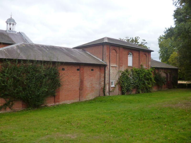
Stable Block. "1836 AH" on tablet. Brick, some stone dressings, slate roofs.
Around courtyard, 8 bay end with 2 storey centre 4 bays, 8 bay sides again with
2 storey centre 4 bays, other end has walls with gateway. Centre 4 bays have
double doors on ground floor and roundheaded sashes with narrow edge panes on
1st floor. Pediment over with stone architrave and clock in oculus. On ridge
cupola of dome on 8 columns, and weathervane. Lower bay each side has 2 planked
doors with blind arch between. Sides have wide coved canopy which reaches out as
far as central pavilion of end. Under are planked doors with 8-pane fanlights and
16-pane sashes beside. Over canopy is raised centre 4 bay block with 12-pane
sashes in each bay. From outside entrance front has to end of sides paired pilaster
on each corner, with stone entablature. Plinth running across and roundheaded sash
in middle. On the inside face, near end, rubbed brick niche, then set back a bay
short tall wall to end canopy, ending in pier topped by stone coping and finial.
From these piers run lower quadrant walls with stone coping ending in smaller pier
surmounted by stone chained bears,
Listing NGR: SU3261827007
External links are from the relevant listing authority and, where applicable, Wikidata. Wikidata IDs may be related buildings as well as this specific building. If you want to add or update a link, you will need to do so by editing the Wikidata entry.


Other nearby listed buildings
