Approximate Location Map
Large Map »
Latitude: 51.0399 / 51°2'23"N
Longitude: -1.5355 / 1°32'7"W
OS Eastings: 432660
OS Northings: 126829
OS Grid: SU326268
Mapcode National: GBR 74M.NMH
Mapcode Global: FRA 76NC.KLM
Plus Code: 9C3W2FQ7+XQ
Entry Name: Urn on Plinth 140 Metres South South East of South West Wing of Mottisfont Abbey
Listing Date: 11 April 1986
Grade: II
Source: Historic England
Source ID: 1093694
English Heritage Legacy ID: 140998
ID on this website: 101093694
Location: Mottisfont, Test Valley, Hampshire, SO51
County: Hampshire
District: Test Valley
Civil Parish: Mottisfont
Traditional County: Hampshire
Lieutenancy Area (Ceremonial County): Hampshire
Church of England Parish: Mottisfont St Andrew
Church of England Diocese: Winchester
Tagged with: Building
MOTTISFONT MOTTISFONT ABBEY
SU 3226
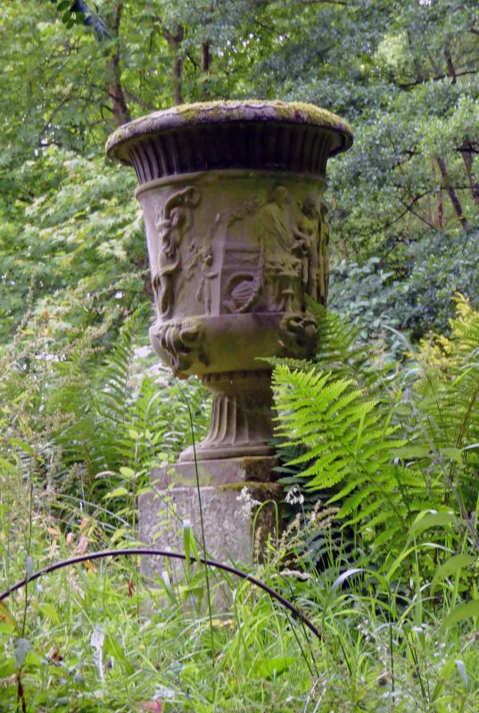
12/13 Urn on plinth 140m SSE
of SW wing of Mottisfont
Abbey
GV II
Urn. C18. Sandstone. On small plinth, 1m high urn with figures decorating
face bucranium below, flinting up to lip above and on scole.
Listing NGR: SU3261827007
External links are from the relevant listing authority and, where applicable, Wikidata. Wikidata IDs may be related buildings as well as this specific building. If you want to add or update a link, you will need to do so by editing the Wikidata entry.


Other nearby listed buildings
