Approximate Location Map
Large Map »
Latitude: 53.4318 / 53°25'54"N
Longitude: -2.2285 / 2°13'42"W
OS Eastings: 384915
OS Northings: 392801
OS Grid: SJ849928
Mapcode National: GBR DXWR.BJ
Mapcode Global: WHB9V.R00G
Plus Code: 9C5VCQJC+PJ
Entry Name: Milestone adjacent to Withington Fire Station
Listing Date: 24 October 2013
Grade: II
Source: Historic England
Source ID: 1415631
ID on this website: 101415631
Location: Withington, Manchester, Greater Manchester, M20
County: Manchester
Electoral Ward/Division: Withington
Parish: Non Civil Parish
Built-Up Area: Manchester
Traditional County: Lancashire
Lieutenancy Area (Ceremonial County): Greater Manchester
Church of England Parish: Withington St Paul
Church of England Diocese: Manchester
Tagged with: Milestone
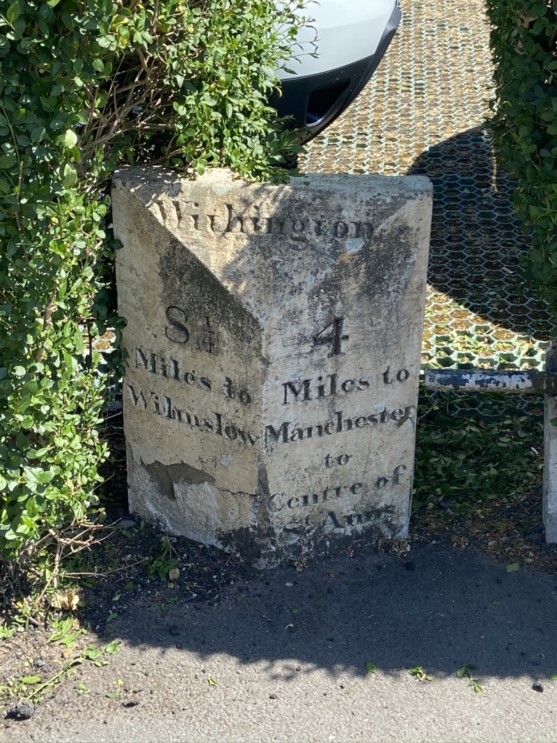
Milestone located on the eastern side of Wilmslow Road, mid-late C19, whitewashed stone, inscriptions to the west side
Milestone located on the eastern side of Wilmslow Road, mid-late C19, whitewashed stone, inscriptions to the west side.
The milestone has a triangular form with a sloping top incorporating incised black lettering that reads 'Withington'. The two faces below have further incised black lettering; that to the left face reads '8 ¼ /Miles to/ Wilmslow', whilst that to the right face reads '4/ Miles to/ Manchester/ to/ Centre of/ St Anns/Square'. The left face incorporates some minor damage to the bottom and 'Square' on the right face is eroded, but remains partially legible.
The milestone adjacent to Withington Fire Station is believed to have been erected by the Manchester and Wilmslow Turnpike Trust in the mid-late C19 and is depicted on the 1st edition OS map published in 1894. The Trust was formed by an Act of Parliament in 1753 to maintain and improve the northerly section of the Manchester to Oxford route, and was abolished in 1881. Wilmslow Road was originally called High Street, then Turnpike Lane, before being known by its current name. Prior to the adjacent fire station being constructed in 1931, the site was occupied by a police station.
The milestone adjacent to Withington Fire Station is designated at Grade II for the following principal reasons:
* Intactness: the milestone is believed to survive in its original location and its lettering remains legible;
* Historic interest: it is an important physical reminder of Withington's transport history, and, in a wider context, the development of England's transport network.
External links are from the relevant listing authority and, where applicable, Wikidata. Wikidata IDs may be related buildings as well as this specific building. If you want to add or update a link, you will need to do so by editing the Wikidata entry.


Other nearby listed buildings
