Approximate Location Map
Large Map »
Latitude: 50.8564 / 50°51'23"N
Longitude: -1.229 / 1°13'44"W
OS Eastings: 454366
OS Northings: 106604
OS Grid: SU543066
Mapcode National: GBR 9B0.83H
Mapcode Global: FRA 869T.YVX
Plus Code: 9C2WVQ4C+HC
Entry Name: Stony Bridge
Listing Date: 22 October 1976
Grade: II
Source: Historic England
Source ID: 1229990
English Heritage Legacy ID: 141579
ID on this website: 101229990
Location: Catisfield, Fareham, Hampshire, PO15
County: Hampshire
District: Fareham
Electoral Ward/Division: Titchfield
Parish: Non Civil Parish
Traditional County: Hampshire
Lieutenancy Area (Ceremonial County): Hampshire
Church of England Parish: Titchfield St Peter
Church of England Diocese: Portsmouth
Tagged with: Bridge
FISHERS HILL
1.
5231
Titchfield
Stony Bridge
SU 50 NW 24/406
II GV
2.
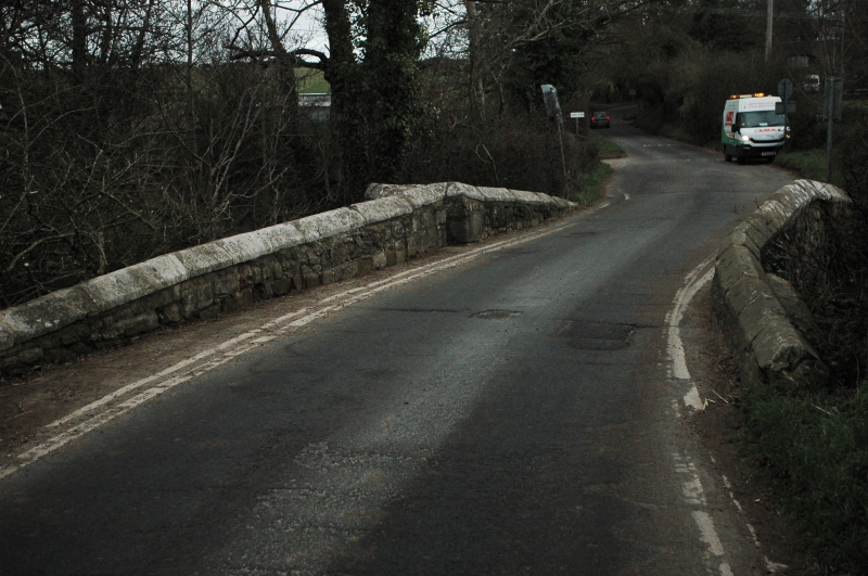
1625. Small bridge of roughly coursed stone with coped parapet. 2 segmental arches
with cutwater between carried up to form a tiny refuge on the north side. Buttress
at the south west end.
Stony Bridge forms a group with Fishermen's Arms and Abbey Cottage, Mill Lane.
Listing NGR: SU5423806617
External links are from the relevant listing authority and, where applicable, Wikidata. Wikidata IDs may be related buildings as well as this specific building. If you want to add or update a link, you will need to do so by editing the Wikidata entry.


Other nearby listed buildings
