Approximate Location Map
Large Map »
Latitude: 51.1483 / 51°8'53"N
Longitude: -0.9778 / 0°58'40"W
OS Eastings: 471595
OS Northings: 139279
OS Grid: SU715392
Mapcode National: GBR B7Z.ZJD
Mapcode Global: VHDYC.0DFK
Plus Code: 9C3X42XC+8V
Entry Name: The 'Wheatsheaf' Public House
Listing Date: 31 March 1977
Grade: II
Source: Historic England
Source ID: 1301724
English Heritage Legacy ID: 141855
ID on this website: 101301724
Location: Alton, East Hampshire, GU34
County: Hampshire
District: East Hampshire
Civil Parish: Alton
Built-Up Area: Alton
Traditional County: Hampshire
Lieutenancy Area (Ceremonial County): Hampshire
Church of England Parish: The Resurrection Alton
Church of England Diocese: Winchester
Tagged with: Pub
MARKET SQUARE
1.
5236
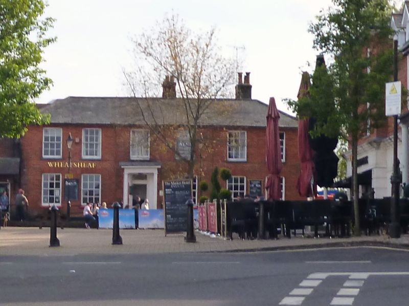
The 'Wheatsheaf'
Public House
SU 7139 2/35
II
2.
Early C19. 2 storeys; 6 bays, the centre 2 advanced somewhat. Red brick; slate
roof. Ground floor with asymmetrically placed porch on slender columns. Sash
windows.
Listing NGR: SU7158439282
External links are from the relevant listing authority and, where applicable, Wikidata. Wikidata IDs may be related buildings as well as this specific building. If you want to add or update a link, you will need to do so by editing the Wikidata entry.


Other nearby listed buildings
