Approximate Location Map
Large Map »
Latitude: 51.1506 / 51°9'2"N
Longitude: -0.9728 / 0°58'22"W
OS Eastings: 471942
OS Northings: 139536
OS Grid: SU719395
Mapcode National: GBR C9B.T1D
Mapcode Global: VHDYC.3B2T
Plus Code: 9C3X522G+6V
Entry Name: 15, Normandy Street
Listing Date: 31 March 1977
Grade: II
Source: Historic England
Source ID: 1338921
English Heritage Legacy ID: 141876
ID on this website: 101338921
Location: Alton, East Hampshire, GU34
County: Hampshire
District: East Hampshire
Civil Parish: Alton
Built-Up Area: Alton
Traditional County: Hampshire
Lieutenancy Area (Ceremonial County): Hampshire
Church of England Parish: The Resurrection Alton
Church of England Diocese: Winchester
Tagged with: Building
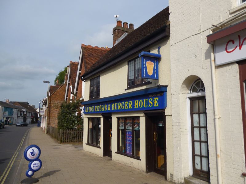
NORMANDY STREET
1.
5236
(South East Side)
No 15
SU 7139 2/62
II GV
2.
C17. Timber-framed, altered. 2 storeys; 2 bays wide. Rendered; tiled roof.
Ground floor with modern shop fronts and door. 1st floor with 2 casement windows.
Nos 11 to 21 (odd) form a group, Nos 11 and 13 being of local interest.
Listing NGR: SU7194539534
External links are from the relevant listing authority and, where applicable, Wikidata. Wikidata IDs may be related buildings as well as this specific building. If you want to add or update a link, you will need to do so by editing the Wikidata entry.


Other nearby listed buildings
