Approximate Location Map
Large Map »
Latitude: 51.1139 / 51°6'49"N
Longitude: -0.9848 / 0°59'5"W
OS Eastings: 471156
OS Northings: 135444
OS Grid: SU711354
Mapcode National: GBR B8K.3TR
Mapcode Global: VHDYJ.W86F
Plus Code: 9C3X4278+H3
Entry Name: Granary 50 Metres South of Manor House Farmhouse
Listing Date: 11 October 1985
Grade: II
Source: Historic England
Source ID: 1302159
English Heritage Legacy ID: 142315
ID on this website: 101302159
Location: Upper Farringdon, East Hampshire, GU34
County: Hampshire
District: East Hampshire
Civil Parish: Farringdon
Built-Up Area: Upper Farringdon
Traditional County: Hampshire
Lieutenancy Area (Ceremonial County): Hampshire
Church of England Parish: Farringdon All Saints
Church of England Diocese: Winchester
Tagged with: Granary
SU 73 NW FARRINGDON CHURCH ROAD
2/36
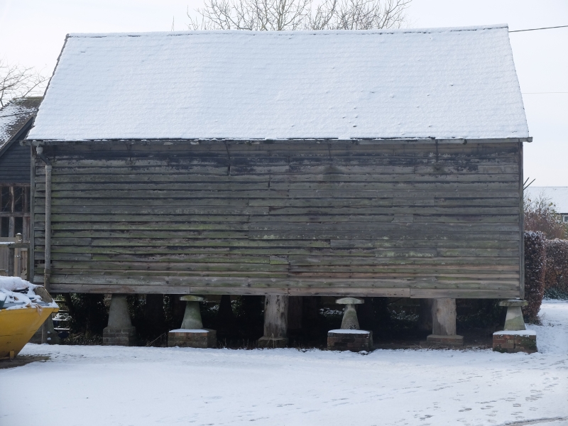
Granary 50 metres south of
Manor House Farmhouse
G.V
II
Granary. Early C19. Boarded Walls. Slate roof. Timber-frame on 4 x 3
staddles. Included for group value.
Listing NGR: SU7132335379
External links are from the relevant listing authority and, where applicable, Wikidata. Wikidata IDs may be related buildings as well as this specific building. If you want to add or update a link, you will need to do so by editing the Wikidata entry.


Other nearby listed buildings
