Approximate Location Map
Large Map »
Latitude: 51.0104 / 51°0'37"N
Longitude: -0.9895 / 0°59'22"W
OS Eastings: 470989
OS Northings: 123933
OS Grid: SU709239
Mapcode National: GBR B9Q.GNT
Mapcode Global: FRA 86TF.VQK
Plus Code: 9C3X2266+56
Entry Name: The White House
Listing Date: 12 March 1986
Grade: II
Source: Historic England
Source ID: 1351112
English Heritage Legacy ID: 142927
ID on this website: 101351112
Location: Langrish, East Hampshire, GU32
County: Hampshire
District: East Hampshire
Civil Parish: Langrish
Traditional County: Hampshire
Lieutenancy Area (Ceremonial County): Hampshire
Church of England Parish: Langrish St John the Evangelist
Church of England Diocese: Portsmouth
Tagged with: House
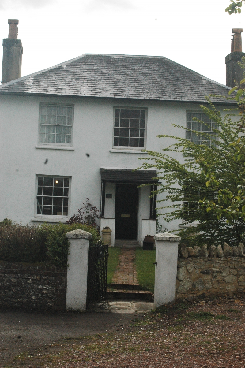
SU 72 SW LANGRISH WINCHESTER ROAD
3/4 The White House
II
House. Early C19. Stucco walls, stone cills. Hipped slate roof. Symmetrical
east front of two storeys, three windows. Sashes, with narrow side panes. Six-
panelled door beneath a late C19 slate hood on posts. At each side there is a
recessed wall with a curving top dropping to a pier. Late C19 single-storeyed
rear extensions.
External links are from the relevant listing authority and, where applicable, Wikidata. Wikidata IDs may be related buildings as well as this specific building. If you want to add or update a link, you will need to do so by editing the Wikidata entry.


Other nearby listed buildings
