Approximate Location Map
Large Map »
Latitude: 50.9768 / 50°58'36"N
Longitude: -1.8962 / 1°53'46"W
OS Eastings: 407386
OS Northings: 119714
OS Grid: SU073197
Mapcode National: GBR 40Y.MFR
Mapcode Global: FRA 66XJ.H42
Plus Code: 9C2WX4G3+PG
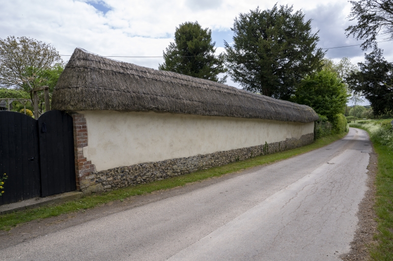
Entry Name: Wall Along Road South of Talk's Farmhouse
Listing Date: 13 February 1987
Grade: II
Source: Historic England
Source ID: 1350992
English Heritage Legacy ID: 144056
ID on this website: 101350992
Location: East Martin, New Forest, Hampshire, SP6
County: Hampshire
District: New Forest
Town: New Forest
Civil Parish: Martin
Traditional County: Wiltshire
Lieutenancy Area (Ceremonial County): Hampshire
Church of England Parish: Martin All Saints
Church of England Diocese: Salisbury
Tagged with: Wall
MARTIN EAST MARTIN
SU 0719
13/4 Wall along road S of
Talk's Farmhouse
GV II
Wall. C18. Cob on flint plinth, brick quoins, thatch coping.
20m long, 3m high wall along roadside.
Listing NGR: SU0741519798
External links are from the relevant listing authority and, where applicable, Wikidata. Wikidata IDs may be related buildings as well as this specific building. If you want to add or update a link, you will need to do so by editing the Wikidata entry.


Other nearby listed buildings
